The lost village of Pinchinthorpe from Newton
7 miles Grey and drizzle
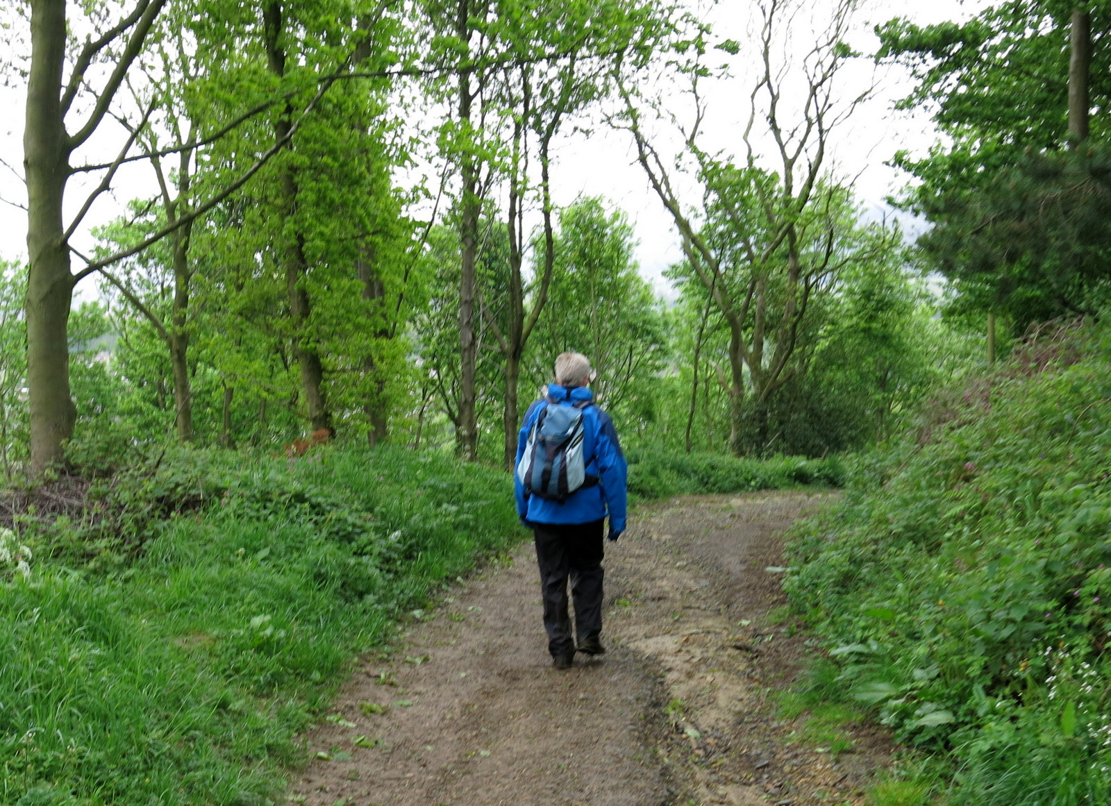
As the weather is so cold and miserable and the hills are covered with low cloud and drizzle, we decided on this walk which we haven't done since 2013.
We parked in the layby at Newton under
Roseberry and walked through the village past the Kings Head pub to the
pay and display car park at the other end of the village. Our track
leaves the main road here and goes directly towards Roseberry Topping
which dominates the skyline.
 |
| Today's walk from The Walker's Guide to the Cleveland Hills |
 |
| The old village hall at Newton |
 |
| Turning towards Roseberry Topping |
|
This track was very muddy and we were
pleased when we reached the gate into the woods under Roseberry where we
turned left. Our track now follows a hedge up to Roseberry Common
towards Bousdale Hill, where we kept left and walked towards a conifer wood in the distance.
This is Hanging Stone Wood and we turned left into a field just as we
reached it.
 |
| Walking towards Hanging Stone Wood |
 |
| Bright display of bluebells |
 |
| Looking back at Newton under Roseberry |
 |
| Newton under Roseberry below us |
 |
| The east side of Roseberry behind us |
 |
| Bousdale Hill ahead |
We left the path at a field gate and walked alongside a rape seed crop before turning right at the bottom of the field where our path led us to Bousdale Farm. The buildings appear unoccupied while renovations are being carried out. Tom Scott Burns explains that Bousdale Farm was built to house Sir Joseph Pease's thoroughbred hunters. There was no water supply so Pease introduced a syphon system using a huge boiler which had done service in the first steamship that berthed in the Tees.
The old stables are an interesting design and it looks as if there are plans to adapt them for holiday homes.
 |
| Hanging Stone Wood ahead, we turn left through the gate |
 |
| Follow the field paths |
 |
| The unmistakable profile of Roseberry Topping in the mist |
 |
| Bousdale Farm |
 |
| The old stables |
 |
| The unusually shaped building |
After the farm our path crossed a field before following the field edge until a forestry track was reached. This gently descended to meet the old disused railway track to Pinchinthorpe station.
 |
| Following field paths |
 |
| Descending the forestry path |
 |
| Newt sculpture near the station |
Pinchinthorpe is an old village. TSB relates that the Domesday Book says Ulchil possessed a manor of 3 carucates, which is the amount of land that could be ploughed in a year using one team, between 60 and 180 acres depending on soil quality, at Torpe. The village's present name comes from the Norman family name of Pinciun who held the land in the 12th century.
We stopped at the cafe here and enjoyed coffee and scones.
 |
| Approaching the cafe on our right |
 |
| The old station, now houses |
 |
| Showing how the station looked in 1964 |
After leaving the cafe we walked along the old railway track that used to run from Middlesbrough to Guisborough, past the old station, all the time with a fine view to Roseberry Topping on our left.
 |
| The old railway track |
 |
| Pinchinthorpe Hall and Roseberry to our left |
 |
| We leave the railway track by the side of this small pond |
We left the old railway track and passing a small pond on our right, we looked across to our right at the strangely named Spite Hall. TSB says that it was well named because it was built by a younger son to obstruct the
view of his elder brother who had inherited Pinchinthorpe Hall, across
the fields.
We crossed a couple of fields towards the Middlesbrough to Whitby line, which is still operational and as we reached it followed the line, staying to the left hand side of the track.
 |
| The Middlesbrough to Whitby railway line |
We followed the railway for a couple of fields and then climbed a stile to cross diagonally towards Nunthorpe Stell. This meant walking through a field of very frisky bullocks who galloped off as we walked towards them.
We admired the stell from the bridge before entering another field of cattle, this time young heifers. To our surprise the cattle did not run away but stood challenging us. We waved our arms and they backed away but as we started to cross the field one heifer charged at us. Clive waved his arms and I waved my walking pole and shouted and it veered away, but came back again and again as we crossed the field. None of the other cattle bothered but this particular beast was determined to see us off. We were glad to get out of the field.
 |
| Nunthorpe Stell |
 |
| I politely let Clive go first |
 |
| Come on girls, we want to be through there |
 |
| The rogue heifer stalks us across the field |
 |
| Shoo cow! |
We walked across a field towards Snow Hall Farm.
TSB wonders at the origin of this name and guesses that it derives from Ann Snowdon
who lived there in the 1890s.
 |
| Pond at Snow Hall Farm |
 |
| Suffolk lambs at Snow Hall |
 |
| Ram alone in adjacent field |
The lane quickly led from Snow Hall Farm
to Newton and the ancient St Oswald's Church. We had a look around
the walls of this interesting old building and admired the Anglo-Saxon carved stone
set in the tower of the church showing a dragon and some sort of
quadruped. Tom Scott Burns says that this stone was actually described
in an eleventh century book called 'Bestiaries'.
TSB notes that until the dissolution of the monasteries this church was run by the monks at Whitby but was made a parish in 1539.
There were some ancient gravestones, some too old to read but we were disappointed to find the church locked.
 |
| St Oswald's Church |
 |
| The old hall, Newton |
 |
| Stone coffin |
 |
| Anglo-Saxon stone carving |
 |
| Even the lych-gate is a listed building! |
 |
| Clive admires the lych-gate |
Across the green from the church stands The King's Head and we wandered over and were made welcome despite our boots and wet leggings. We sat with a pint of Black Sheep Holy Grail and discussed the day's walk.