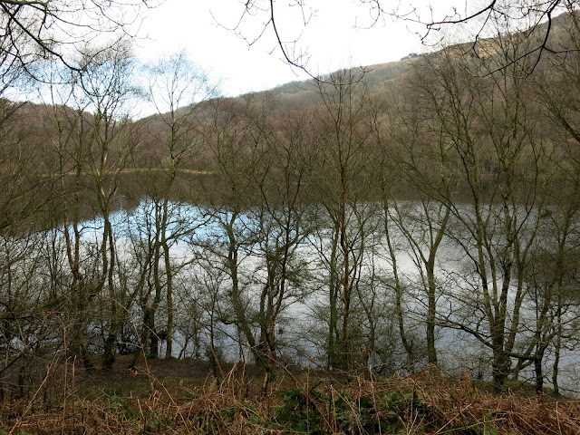
"There must be dales in Paradise
Which you and I will find.."

Thursday, 11 February 2016


Kilburn White Horse Circular Walk


5.5 miles             Cold and clear


We ignored Tom Scott Burns's advice to park at the pay and display car park opposite the information centre as it has become an expensive proposition and instead parked in the free National Trust car park below the White Horse.


Today's walk from The Walker's Guide to the Hambleton Hills

The White Horse at Kilburn from Low Town Bank Road

As we approached the car park the White Horse became clearly visible and I took a quick photograph as this might be the best view of it we would get today.  

From the car park the White Horse was missing its head and looked as if it was due for its triennial 'tidy up'.  We walked back into the road and turned right downhill, soon joining a footpath to the left and above the road, on which we stayed until we reached the next small car park on Low Town Bank Road.

View from the car park
Footpath above the road

Just beyond this car park we turned right from the road into a track which we followed through trees and then fields towards Hood Grange Farm.  As we walked quietly along the track we surprised some deer that quickly took off before I could get a clear photograph of the stag.


Winter feed

We turn off the road into a farm track

Lots of snowdrops among the trees

What's that?! I fumble with my camera...

.... but get a good rear view as they run off

The farm track gave way to field tracks across the charmingly named Happy Valley, which would have been very mucky but sub-zero temperatures kept the ground crisp this morning.  We reached Hood Grange Fram which TSB tells us is an ancient farmhouse where a hermitage once stood, occupied by Robert de Alnetto, who had been a monk at Whitby Abbey.

Our track was diverted round the farmhouse and as we passed through farm gates we were thankful for the frozen ground as it would otherwise have been impassible with mud.


A very unusual stile at Hood Grange Farm


Looking to our right is Roulston Scar

Approaching Hood Grange Farm

Crisp ground made the going easier

We walked along the farm track to meet the A170 noting a neat memorial and graves of residents of the farm. Next to them was a small unmarked grave and we wondered if it belonged to a dog.
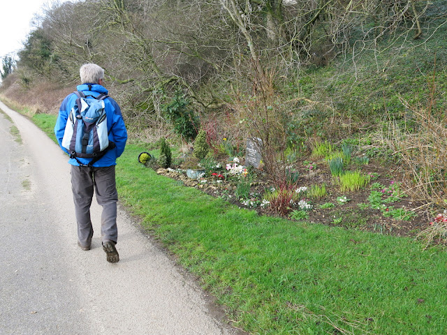
We notice a neat grave....


.... and adjacent, perhaps a pet's grave?

We reached the A170 and almost immediately crossed over to join the farm track of High Cleaves Farm, shortly turning right along a fenced field track to the little valley of Butter Dale, which TSB says was cut by ice melt water in the last Ice Age.  A stiff climb took us past a small lake at Gormire Rigg and then we swung right to reach the edge of Gormire Lake, on the opposite side of the lake to our walk of a couple of weeks ago.

High Cleaves Farm

Small lake at Gormire Rigg

A path diversion around High Cleaves Farm

Clive admires a display of snowdrops


In Gormire Woods, was this once a building?

We suddenly see Lake Gormire

View as we follow the path around the lake

As we reached the southern end of the lake we came across a rudimentary bench with a lovely view across the lake.  Too good to pass by, we sat and enjoyed our coffee and scones.


A nice spot for coffee

We continued around the lake shore until we reached the climb to Whitestone Cliff through Garbutt Woods. We knew what to expect and a steep twenty minute climb in silence followed, punctuated only by the occasional regretful remark that perhaps we shouldn't have eaten the last few biscuits.  

We reached the top at last and instead of turning left towards Sneck Gate we turned right, signposted Sutton Bank.  We now walked along a path for about 1.5 miles, following the ridge, with magnificent views into the Vale of Mowbray below.  TSB explains the underlying cliffs are comprised of Coral Rag or Coralline Oolite, alternate layers of coarse shelly limestone full of fossils and hard flint.  During the Ice Age glacial sheets, unable to override the Cleveland Hills, swept round both sides of the moors carving out the great cliffs at Gormire and Roulston Scar.   Opposite us was the cone shaped Hood Hill where a number of barrows and earthworks are located around the summit.

Up and up..

.. and up and up

At the top we turn towards Sutton Bank

A plethora of signs

Gormire below

Hood Hill
Reaching the Visitor Centre and the A170 again, we crossed the road and continued along the trail, on a path that was known as Thieves' Highway in ancient times, apparently as it was used as a getaway route after plundering travellers on the Hambleton road.  On our left was the Yorkshire Gliding Club and we continued around the headland to arrive above the White Horse, just below our path.  Our track ran down steps to the car park below and the end of our walk. 

Roulston Scar


Hood Grange Farm below

Roulston Scar


We are above the White Horse's ears!

Steps down to the car park

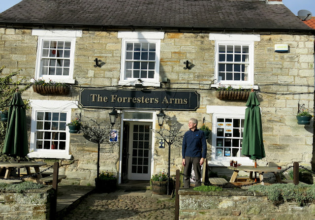
A short drive took us to the village of Kilburn where we found the Forresters Arms and a sun trap at the front of the pub allowed us to enjoy our first outdoor pints of the year as we discussed today's walk.


Cheers!


Thursday, 4 February 2016


The Drove Road and Windy Gill Ridge from Boltby


7 miles                        Bright and breezy


We hadn't done this route since 2014 and as it is a high level walk and therefore likely to be good under foot, we headed back to Boltby and parked in the same spot as last week.  This time however we headed away from Boltby with High Barn, where we walked last week, visible on the horizon to our right.

Today's walk from The Walker's Guide to the Hambleton Hills

Looking over to High Barn among the trees on the horizon

After 100 yards we turned left into a lane to follow the farm path to Lunshaw House Farm.  Before reaching the farm we crossed a stile on the right to follow a field path signposted Low Paradise.  Our path followed the camber of the hill for some time, meaning we were walking at a 45 degree angle, until it dropped down into woods before Lunshaw Beck.  


Turn left off the Boltby road

Leaving the farm track to enter fields

An awkward walk across sloping fields

Woods before Lunshaw Beck

Low Paradise Farm appears in the distance

Crossing the beck we started a mile ascent which TSB describes as a 'muscular climb'.  We passed by the always well ordered Low Paradise Farm to reach Oak Cottage where we have encountered hounds previously.  Today there were only a couple of young dogs in a cage, perhaps the hounds were out being exercised.


Low Paradise Farm

Young dogs at Oak Cottage

The track climbed relentlessly upwards until we reached High Paradise Farm where I curled my lip at the sign saying the tea room is closed until March.  We were now walking on the Cleveland Way and soon reached the moor and Sneck Gate where we joined the Hambleton Drove Road.  At Sneck Gate we saw a walker on the moor, several hundred yards away, and then noticed with alarm that the walker seemed unaware that his large dog had seen us and was running towards us at full tilt.  It skidded to a halt in front of Clive and dropped a ball at his feet.  Phew.  Clive threw the ball back towards the hiker and we resumed our walk.


Passing High Paradise Farm

Gerarrt of it!

We followed the Drove Road along the moor top, eventually entering forestry and getting out of the irritating wind. As we entered the trees we saw a flock of small birds which appeared to be a mixture of finches and, more excitingly, Yellow Hammers.  I got a shot of a Yellowhammer with some difficulty as they were very nervous and flew off as soon as we looked in their direction.  We walked on through the trees for some time and then, just before reaching the ruins of Steeple Cross (first mentioned in 1246 but now just a 2 feet high piece of stone) we found an inviting old tree trunk in the sun and sat down to enjoy our coffee and scones.  


Yellowhammer

Out of the wind, sun, scones and coffee.  What could be more welcome?

We turn left off the Hambleton Drove Road

We turned left just before Steeple Cross and walked through the forestry plantation which seemed to have been ravaged since our last visit, no doubt to feed the biomass boiler at the power station in Teesside, and emerged at Gallow Hill, where we had a nice view towards Cowesby village.


Following the forestry path towards Gallow Hill

Looking towards the A19 from our path

Huge areas of devastation

Cowesby from Gallow Hill


Is this sign on Windygill Ridge necessary or is it a blot on the landscape?


We turned left at Gallow Hill and followed the broad path to Windygill Ridge. To the left of our path was a forestry plantation and ahead a fine vista across the Vale of Mowbray and to the right Black Hambleton and the hummock of Seta Pike.  Just after passing Seta Pike our path turned left into a steep forestry path.  The track was rather faint and also very boggy; the steep descents proved very slippery and progress was slow.   The path levelled out and we picked our way through Gurtof Wood, looking down on Gurtof Beck which ran below us.  Quite a lot of trees had been blown down in the recent storms and a few had fallen awkwardly across our path making diversions necessary.  After a mile or so we reached a gate leading out of the trees into wet meadows.


After Seta Pike turn left onto a small track

Our path can be seen running ahead of us until it reaches a sharp descent

Mud makes for a tricky descent

Down into the dark woods....
  
We had to divert right for a while to pass fallen trees


Out of the woods at last
Our faint path crossed several meadows, all made very boggy by the rain, until we came to a wide track through fields of decaying maize.  The corn cobs were still on many of the plants and as there were plastic bird feeders in among the crop we guessed it had been left as cover for game birds.  


Clive unzips a corn cob


Our path exited at the west end of Boltby village and we turned left to walk along the road.  Set back from the road is Holy Trinity Church and finding it unlocked we entered for a look around.  The church is in very good repair and as TSB says that the church was first erected in 1409 and was continuously in use until it was rebuilt in 1859, we were surprised to see that the churchyard only seemed to contain fairly recent graves.  A further look at our guidebook 'The Walker's Guide to the Hambleton Hills' explained why: apparently it was the custom until Victorian times to carry the dead from Boltby for burial at Felixkirk, "swathed in linen and uncoffined."  Unfortunately the book does not say why this happened when they had a perfectly good church in Boltby.


Kneeling ram at Boltby

The Pony Trek business used to be a pub, The Johnson Arms

Holy Trinity Church

Looking towards the altar

Organ at the rear of the church

Altar window

Interesting side window

Leaving the church we continued through the village to the steep climb back to our car, pausing briefly to celebrate spotting a 'new' weather vane.  The villagers of North Yorkshire appear to have a custom of mounting individually designed weather vanes on their houses and I am amassing a nice collection of photographs!


Weather vane in Boltby