Along the Old Drover's Road from Osmotherley
6 miles Cold and crisp
We had intended a walk from Carlton today but turned back after being unable to get up Carlton Bank because of ice. Instead we drove to Osmotherley and parked in the village opposite the Queen Catherine pub.
 |
| Today's walk from The Walker's Guide to the Cleveland Hills |
We walked through the village noticing a couple of new (to us) weather vanes, past the
pinfold in Quarry Lane and
turned left into Rueberry Lane.
 |
| Pinfold, where stray animals were kept until being returned after payment |
 |
| Turning into Rueberry Way, following the Cleveland Way sign to Scarth Nick |
Tom Scott Burns notes that in the Domesday Book
the village was called Asmundrelac, meaning Asmund's Clearing. The
village was ravaged by William the Conqueror in 1069 and was still
described as waste land in its entry in the Domesday Book in 1085.
Rueberry Lane led us to Lady Chapel which was founded by Catherine of Aragon in 1515, and as we approached the Chapel we saw that the Stations of the Cross are marked out on the right side of the path. We passed by the Chapel and dropped down to a field track which would have been very muddy but which was walkable today because of the crisp conditions.
 |
| One of the Stations of the Cross |
 |
| Lady Chapel |
 |
| Too early in the walk to take advantage of the seat in the sun |
 |
| Our paths were still very crisp from last night's freezing temperatures |
 |
| Looking across at the A19 and picking out landmarks |
We rejoined the Cleveland Way at this point, following it uphill through the birch trees of South Wood to reach transmitter masts. Passing through gates at the side of the masts we followed the Cleveland Way upwards towards Scarth Wood Moor, all the time enjoying a fine prospect towards the Cleveland Hills, and in the foreground Whorl Hill.
 |
| Confusing sign, the C to C and the Cleveland Way use the same path eastwards |
 |
| Climbing Swinestyle Hill towards Beacon Hill |
 |
| Lots of flooded fields - the building in the centre is the Tontine Inn |
 |
| The birch trees of South Wood |
 |
| Approaching the transmitter masts at Beacon Hill |
 |
| Crossing Scarth Wood Moor towards Whorl Hill |
 |
| Swainby Village and Whorl Hill to the right |
Eventually we reached a wooden sign at the deep trough of Scarth Nick, pointing towards Cod Beck Reservoir, and we left the Cleveland Way to soon reached a tarmac road that runs from Swainby to Sheepwash. TSB explains that during the Ice Age of approximately 20,000 years ago, a glacier from the north enveloped an area 20 - 30 miles wide and 1000 or more feet thick. It failed to cover the moors but crept into Scugdale depositing materials from Scotland, Cumbria and Durham. Sand, gravel and stones left by meltwater formed the conspicuous mound of Round Hill, the present car park at Sheepwash.
Reaching the water splash at Sheepwash we sat in the sun and enjoyed coffee and scones with the pleasant background accompaniment of burbling water.
 |
| Approaching our turn off the Cleveland Way |
 |
| Clive looks over Scarth Nick |
 |
| Car Park at Round Hill |
 |
| Approaching Sheepwash |
 |
| A perfect spot for coffee and scones |
Crossing the beck we climbed up Pamperdale Moor, our path running alongside the woods that drop down to the reservoir. This path is known as High Lane and is the old Drovers' Road. TSB says that it was probably used by prehistoric man, the Romans and before the present day road was made, as a corridor through the Cleveland Hills. Just as we reached the tarmac road from Osmotherley we saw the ruins of Solomon's Temple, which was built by the eccentric Solomon Metcalf in 1812 and had images of the sun, moon and stars on its walls.
We followed the tarmac road to Chequers Farm. This interesting
building was an old inn and held a licence for 300 years until 1945.
When it was a hostelry it was famous for keeping an old peat fire alight
for 150 years! The sign of the Inn was a chequers board signifying
that it would change money for the drovers and on the sign was the
cryptic message "Be not in haste, Step in and taste, Ale tomorrow for
nothing.' As we all know, tomorrow never comes! The old sign has been
mounted behind glass on the farm wall.
 |
| Melt-water runs alongside the Drovers' road |
 |
| Looking back along the Drovers' road |
 |
| The remains of Solomon's Temple |
 |
| The old Chequers Inn |
TSB notes that drovers used to
bring vast herds of cattle from the Highlands of Scotland across the
Hambleton Hills on their way to the markets of East Anglia, the Midlands
and London. Their average pace was just 2 miles per hour.
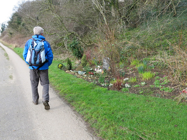
We turned right off the Drovers' road onto a green track and almost immediately saw a small shrine against the wall on our left side. When I reported this shrine in my blog a year or so ago I received a nice email explaining its significance, which I'll copy here:
a sutton6 March 2015 at 11:29
The shrine you mention is that of
my Mam. The significance is my Mam and Dad spent a glorious day together
walking around Osmotherley in 1945 and they had a photograph taken
there as a young couple, Dad in his uniform. He was a Paratrooper in the
6th Airborne, 9th Battalion. He was only 18 years old when he dropped
on D day in Normandy and on the Rhine crossing, he had a miraculous
escape, saved by a tiny cross which stopped a machine gun bullet. He has
written a book called 'A Teenager's War' by Ron Tucker, it is a moving,
heartwarming, funny story and there are photographs of them at the very
same spot in Osmotherley! and if anyone is interested we sell his book
for £13 (inc p&p) and all the proceeds go to S.A.F.A.
We can be contacted at g.a.sutton@ntlworld.com, please feel free to email.
 |
|
The green track led us down to Oakdale past Oakdale Farm where working dogs in a kennel watched us pass by and we joined the farm road across Slap Stone Beck (apparently this name refers to slippery stones at the ford).
 |
| Looking back at Chequers... |
 |
| ... as we follow the green path down to Oakdale |
 |
| Dogs at Oakdale Farm |
 |
| Oakdale Farm |
 |
| Approaching Slap Stone Beck |
Crossing the Osmotherley to Hawnby road once more, we passed through the gates of White House Farm, which has a lovely view of Osmotherley from its large bay windows. The path has been diverted here away from the farm, and as we were once again on the Cleveland Way we found that the track downhill across fields has been heavily used and is very slippery as it descends to Cote Ghyll.
We found it difficult to remain upright on this stretch and hard to find a decent way down to the bridge across the beck. Once over the water we faced an immediate and very steep climb out of the trees to reach a stone slabbed path across fields to Osmotherley.
 |
| Passing through the gates of White House Farm |
 |
| White House Farm from behind |
 |
| White House Farm from the front |
 |
| Tricky descent from White House Farm to Cote Ghyll |
 |
| Crossing the beck |
 |
| View upstream |
As we entered the village along narrow alleyways we noticed an old chapel in the terraced row of cottages, obviously still in use. Tom Scott Burns tells us that John Wesley preached in Osmotherley in 1745 and the chapel was built nine years later. Wesley returned to preach again at Osmotherley in June 1761, and probably used this chapel.
 |
| Slab path across fields to Osmotherley |
 |
| A cheeky rabbit ignores our presence |
 |
| Alleyways into the village |
 |
| We spot the old Chapel |
 |
| Emerging into the High Street |
 |
| The Queen Catherine Hotel |
The alley emerges opposite the cross and beyond that we spotted the Queen Catherine Hotel, where we soon relaxed with a pint of XB Bitter and reflected on our day's walk.


