"There must be dales in Paradise
Which you and I will find.."

Friday 6 December 2013

A Bilsdale Circular from Clay Bank

5 miles                 Very cold and sunny


We parked at Clay Bank car park which Tom Scott Burns tells us was once a Bronze Age burial site.  It was excavated in the 1960s and found to have eight burials from around 1500BC.


Today's walk from The Walker's Guide to the Cleveland Hills


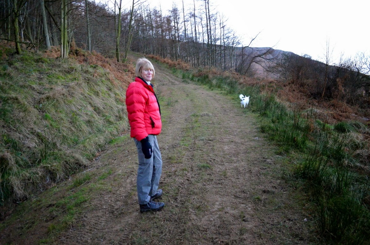
Looking back towards the Bilsdale Road

We walked North back down the Bilsdale road and turned off after a couple of hundred yards into a forestry track which meanders downhill and eventually turns sharp left, almost immediately reaching Spring House.  The track here is invisible and one appears to be entering a private drive which ends at Spring House. We walked warily up to the house, passing signs saying, 'Dogs running loose', Thieves Beware and several other welcoming messages.  The owners of Spring House obviously want to discourage people but my GPS told me that our track was definitely there so we soldiered on by the house and a little later came to a friendly yellow way-mark proving that we did have right of way.


Tracks today were little used

Spring House, difficult to negotiate

Open land after Spring House

We now walked along the base of the Cleveland Escarpment on little used paths that were often impeded by bramble and holly, until we met Bank Lane running up from our right after which our path became a more substantial farm track.


Our path along the base of the Cleveland Escarpment

A better track at last


Attractive house on our path

We passed an old house called Huntons Folly and then came to a farm with the unusual name of Solomon's Porch where we turned left off the farm track and crossed a stile.


Huntons Folly

Solomon's Porch to the right

Leaving the track st Solomon's Porch to begin our climb
 
We now faced a long, steady uphill path to Cold Moor, where, hot from the effort of climbing, we sat on a wall in the sun and enjoyed our coffee and scones.


Climbing to Cold Moor

Lunch in the sun

Climbing to Cold Moor

We set off again and followed the track over the top of Cold Moor towards the Wainstones.  A steep descent off the top of the moor was followed by a right turn just before the climb to the Wainstones.  We walked around the plantation edge to Garfitt Gap.  Apparently this was known as Garthwat in 1335, meaning 'a clearing with a garth (enclosed yard) on it'.


Looking back from Cold Moor

Carole walks towards The Wainstones

First glimpse of Garfitt

There is still a nice 'garth' there today and on reaching it we turned sharp right, leaving the forest track and crossing a stile to go past the front of the the house.  Our track took us gently down from Garfitt to the Bilsdale Road.


Garfitt

Walking down to the Bilsdale Road

We turned left here and walked alongside the busy road keeping Pirate on a short lead before crossing the road to join a track at a metal footpath sign.  This footpath was also the entrance to Holme Farm and TSB has a photograph from 1896 in his book The Walker's Guide to the Cleveland Hills; the farm still looks exactly the same today.


Holme Farm

Footpath was once the old road to Hasty Bank

The little used footpath from the farm was once part of the old road to Hasty Bank and our track followed it all the way back to the car park. 

An interesting short walk that was somewhat spoiled by awkward path-finding near several buildings which one suspects has been made deliberately difficult.


Friday 29 November 2013

The lost village of Pinchinthorpe from Newton


7 miles       Bright and windy


We parked in the layby at Newton under Roseberry and walked through the village past the Kings Head pub to the pay and display car park at the other end of the village.  Our track leaves the main road here and goes directly towards Roseberry Topping which dominates the skyline.


Today's map from The Walker's Guide to the Cleveland Hills

 
Roseberry from the Newton Road


Muddly lane to Roseberry Topping


This track was very muddy and we were pleased when we reached the gate into the woods under Roseberry where we turned left.   Our track now follows a hedge up to Roseberry Common where we kept left and walked towards a conifer wood in the distance.  This is Hanging Stone Wood and we turned left into a field just as we reached it.


Looking down to Newton from Roseberry Common


Roseberry from the common


We now followed the yellow way-marks through several fields until we reached Bousdale Farm, once Sir Joseph Pearce's stud farm.  The old stables with their unusual shape have been converted to holiday cottages.


Old stables at Bousdale Farm


Leaving Bousdale Farm


Walking past the farm we reached a forestry gate which we passed through, following the track nearly to Hutton Gate where we turned sharp left.  Still following the forestry track we walked down to meet the old railway track which led to the old station at Pinchinthorpe and a dog- friendly cafe.


Approaching Cafe to the right


At the cafe we enjoyed coffee and scones and set off much refreshed to walk along the old railway line for another two miles. We soon passed the original station built in the 1850s and now a house, and then a few yards later saw the slightly newer and larger station house from the 1870s, now converted to several houses.   As we walked along the old railway track we looked at the strangely named farm Spite Hall to our left.  Tom Scott Burns tells us that the farm is aptly named because it was built by a younger son to obstruct the view of his elder brother who had inherited Pinchinthorpe Hall, across the fields.


Old station on left


Slightly newer station!


Two mile walk along old railway track


 After half an hour's march along this dead straight and level track (which would have been boring without the constant view of Roseberry Topping to our left) we reached a stile which we crossed into fields that led us to the Middlesbrough to Whitby railway line.


Leaving the old railway track


Duck house


We turned sharp left before the line as our route was now south for a short while before cutting across a field towards Snow Hall Farm. TSB wonders at this name and guesses that it derives from Ann Snowdon who lived there in the 1890s.


Crossing Nunthorpe Stell


Pond at Snow Hall Farm


Snow Hall Farm


Suffolk Sheep at Snow Hall  "We have reason to believe one of you is an imposter."


The lane quickly led from Snow Hall Farm to Newton and the ancient St Oswald's Church.  We had a look around this interesting old building and admired the Anglo-Saxon carved stone set in the tower of the church showing a dragon and some sort of quadruped.  Tom Scott Burns says that this stone was actually described in an eleventh century book called 'Bestiaries'.


St Oswald's Church


Saxon Carving


Ancient stone coffin found under church floor


We crossed the green to the main road and returned to our waiting car, pausing for one last look at Roseberry Topping, the Cleveland mini-Matterhorn, looking magnificent in the afternoon sun.


Friday 22 November 2013


Whorlton Castle and Church from Swainby

6 miles                           Cool and fine


We parked at the road side in Swainby opposite the Black Horse Pub and crossed the bridge to walk up the High Street.  We turned left into a marked footpath behind houses that soon led to Church Lane, which we followed to Whorlton Castle.


Today's walk from The Walker's Guide to the Cleveland Hills


Swainby

The castle gatehouse door was standing open and we went through it for a look around.  Tom Scott Burns says that the castle was mentioned in the Domesday Book as Wiruelton and had a chequered history passing from the de Mortain to the de Meynell family. In 1323 Edward II stayed there while hunting deer.   Later, in the Cromwellian period, Royalists held the castle and were bombarded from Whorl Hill by Roundheads. 

 
Whorlton Castle Gatehouse


Rear of Gatehouse - not sure if the red paint is graffiti or official


Our route would shortly be taking us to Whorl Hill but first we stopped off to look around the old Holy Cross Church which was near the castle.  The church is late Norman and partly in ruins but interesting to explore.  TSB writes that it was built on an old Roman site and pottery and other artifacts have been found there.


Holy Cross Church

Sadly we found no artifacts and leaving the church we walked up to the junction with Whorlton Lane before cutting across field tracks to Whorl Hill.  Last night's torrential rain made these tracks heavy going.  Our route turned into woods opposite a farm and we followed the edge of these woods around Whorl hill emerging near a bungalow on Bank Lane.


Approaching Whorl Hill across field tracks


Looking back at Whorlton Castle


Which way? Our path is hidden by fallen beech leaves

Walking through Whorl Hill woods

A steady climb up Bank Lane was followed by a very steep ascent through woods to Live Moor where we joined the Cleveland Way just below Gold Hill.   


Bank Lane


Emerging below Gold Hill after steep climb through woods


We join the Cleveland Way

We turned right and followed the Way to a large cairn which provided a sheltered spot for our coffee and scones and gave a good view into Scugdale to one side and down to Whorl Hill on the other.


Scugdale from our coffee stop


Whorl Hill from our coffee stop

Refreshed and still following the Cleveland Way we descended steeply down to Huthwaite Green, sliding on the muddy path whose stones were made more slippery by a covering of pine needles.  The last time Clive and I walked down this path we saw a large deer in the woods and today we walked quietly hoping to repeat the experience but saw nothing.


Approaching Scugdale on the Cleveland Way


Slippery descent to Huthwaite Green

We crossed the ford below Hollin Hill Farm and then walked over fields to join a forestry track above Scugdale beck.  The track led us to a tarmac road just above the old railway and we were surprised to see an ancient railway goods truck, minus its wheels, at the side of the road.


Old railway truck


Crossing Scugdale Beck at ford


Whorl Hill in the distance from forestry track

Scugdale, Barkers Ridge top right, from forestry track above Scugdale Beck

A pleasant walk along this road brought us back into Swainby and eventually to our car. 


Forestry track above Scugdale Beck


Looking down to Swainby


Whorlton Recreation Rooms, now Swainby Post Office