KILDALE TO BAYSDALE AND ITS LOST ABBEY
9 miles Bright and fine
We parked in the lay-by in Kildale village and walked out of the village along the same road, towards Little Kildale.
 |
| Today's walk from The Walker's Guide to the Cleveland Hills |
Tom Scott Burns informs us that Kildale is a village of great antiquity. There are several 'Kildals' in Norway and the village was probably named by the Vikings. It was called Childale in the Domesday Book. Walking through the village we passed a beautiful display of snowdrops at the entrance to Kildale Hall and then turned right to walk up through Little Kildale where we stopped to chat to a couple of Shetland Ponies.
 |
| Snowdrops at Kildale Hall |
 |
| "Have you got any apples?" |
|
|
|
We walked through Little Kildale Wood and came to Warren Farm where we turned right and headed towards the moor. We descended for a while, to cross the source of the River Leven and admired a fine brick chimney on our left. TSB tells us that this is the remains of an ironstone mine that was operational between 1866 and 1874. We continued past the mine and climbed steadily towards Kildale moor.
 |
| Old ironstone mine |
 |
| Looking back towards Warren Farm and the old mine. |
 |
| The Moor Gate |
|
|
On reaching the moor our track continued straight ahead and we negotiated it with some difficulty, the overnight rain having made it more of a stream than a path. After crossing the top of the moor we descended towards the valley of Baysdale, turning sharp left when we came to the ruins of an old stone barn.
 |
| Descending into Baysdale |
 |
| Turn left at the disused barn |
Our path took us along Baysdale valley, walking parallel with Baysdale Beck for a mile and a half until we reached the road and dropped down to Hob Hole. The beck was in full spate and we saw a car turn back rather than cross the water-splash where the sign was showing a depth of 1 foot. We crossed the beck by the bridge and dropped down to sit out of the wind to enjoy our coffee and scones.
 |
| Hob Hole |
 |
| Deep water! |
 |
| Our view from our coffee stop |
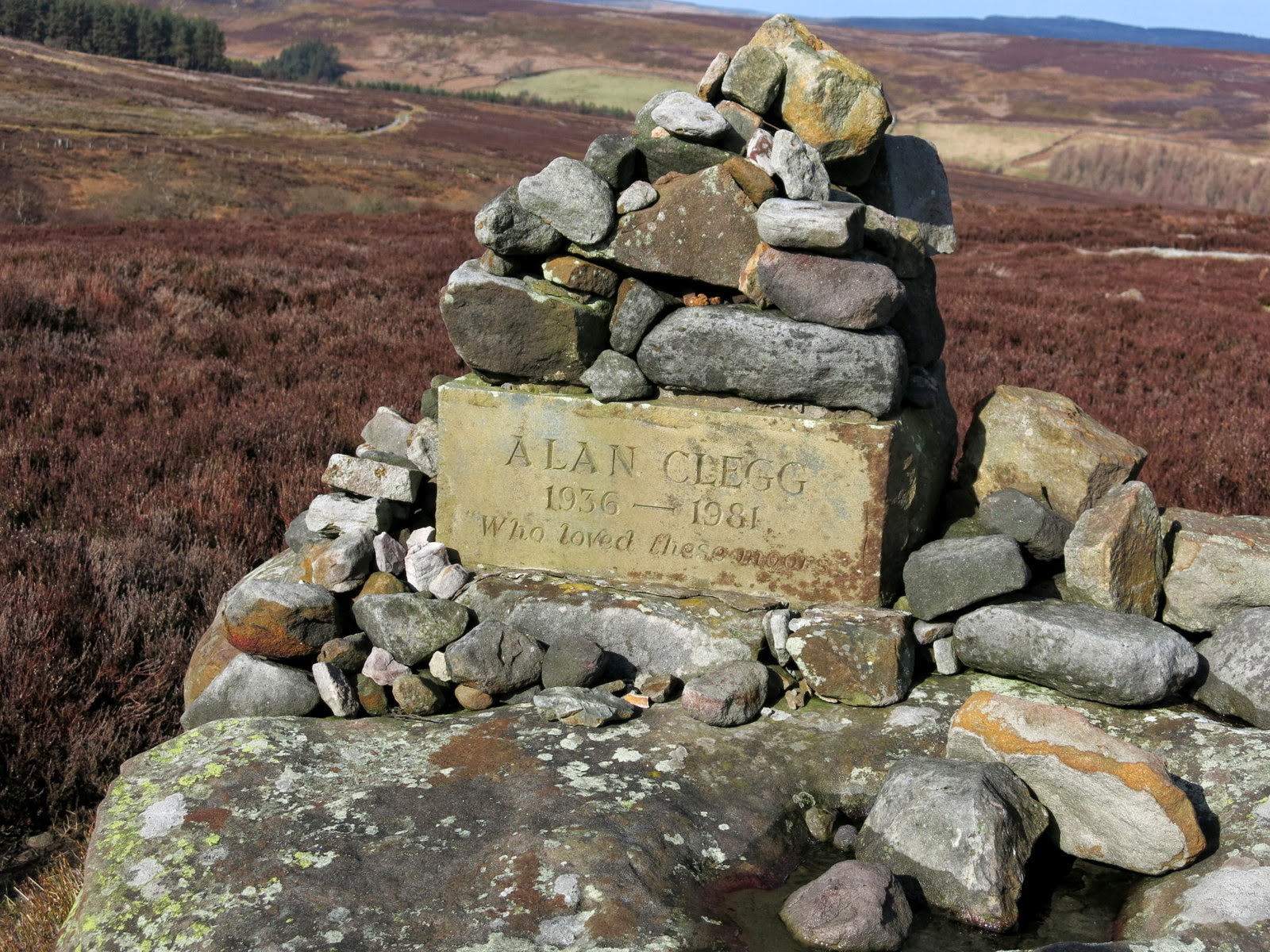
Hob Hole was supposed to be the haunt of a mischievous hobgoblin who taunted weary travellers and TSB reports a Canon Atkinson speaking of Padfoot, sometimes visible and sometimes not, padding quietly behind a traveller and then uttering a roar in his ear. Fortunately our coffee stop was untroubled by Padfoot and feeling refreshed we continued walking uphill on the road from Hob Hole before turning first right into John Breckon Road. After half a mile our path turned right off the road and returned us back along the opposite side of Baysdale Beck passing a memorial to Alan Clegg 'Who loved these moors'. We arrived at a small stone footbridge over the beck and were surprised to see a wooden memorial seat. It looked a little out of place and we wondered at the effort of getting it to this remote location. The bridge was built in 1938, according to an inscription and was the work of Rowland Close, of nearby Low House.
 |
| John Breckon Road |
 |
| Kildale Moor |
 |
| Our path leaves John Breckon Road |
 |
| Wet paths made difficult walking |
 |
| Funny place for a park bench! |
Just past the stone bridge we turned right onto a wide track and our progress speeded up after the difficulties of negotiating wet and muddy paths across the moor. We walked down hill and passed by the above mentioned farm called Low House and then walked along the valley bottom to Baysdale Abbey. The original abbey was occupied by 9 or 10 nuns from 1190 to 1539. We were interested to see a bat box on one of the abbey buildings and then walked away from the buildings across a quaint stone bridge which is apparently the only substantial remnant of the original abbey.
 |
| Walking towards Low House Farm |
 |
| Looking up from Low House farm to the old barn we had passed earlier |
 |
| Baysdale Beck |
 |
| Walking towards Baysdale Abbey |
 |
| Sheep at Baysdale Abbey |
 |
| Bat box! |
 |
| Baysdale Abbey |
 |
| Old bridge to Baysdale Abbey |
|
|
We walked along the tarmac road from the abbey and then went right on a faint path across fields on a direct route uphill from the road, shown as a dotted line on the above map. This cut down the road walking but was very steep and we eventually rejoined the road we'd left and continued walking towards Kildale. After a few minutes walking on this road we saw a stone memorial to the crew of a second world war plane that had crashed on Kildale Moor; sadly the crew died from exposure before they could be rescued.
 |
| Steep 'short cut' |
 |
| Looking back to Baysdale Abbey |
 |
| Memorial to WW2 plane crash |
The walk along this road takes an hour and we found it quite wearying to walk on tarmac for so long at this stage of the hike. Eventually Kildale Church came into view and we dropped down to the road and our car. A very enjoyable walk with fine views.
 |
| Captain Cook's Monument and Roseberry Topping from the Kildale Road |
 |
| A long walk on tarmac |
 |
| Kildale |