Kepwick and Cowesby from Over Silton
5.5 miles hot and sunny
After 5 months of nursing a sore heel at last I am fit enough to return to walking in the hills. Nothing too demanding at first, but one of Tom Scott Burns' prettiest walks in the Hambleton Hills.
 |
| Today's walk from 'The Walker's Guide to the Hambleton Hills' |
|
|
We approached Over Silton from the A19 and parked at the road side. Tom Scott Burns tells us that the name Silton probably derives from Sal (as in Up-sal) which means a Hall or important place, and Ton which is Anglian for a place or town. We headed east out of Silton and immediately looked for a field track turning right off the road. We walked across a couple of fields following yellow markers, our track unused and invisible in the long grass, and soon came to the very neat Greystone Farm whose fields are full of Suffolk sheep and horses. As we passed the farm buildings we saw an open barn full of rosettes and ribbons and stopped to admire them. "That's just a few of 'em!" said a voice behind us and we turned to see the farmer, standing with a pint pot of tea in his hand. He told us the prizes were mainly for his 'Suffolks' and represented an 'eck of a lot of work.'
 |
| 'Just a few of 'em!' |
 |
| Suffolk sheep at Greystone Farm |
 |
| Greystone Farm |
 |
| Clive treats a horse to a Jakeman's Throat and Chest lozenge |
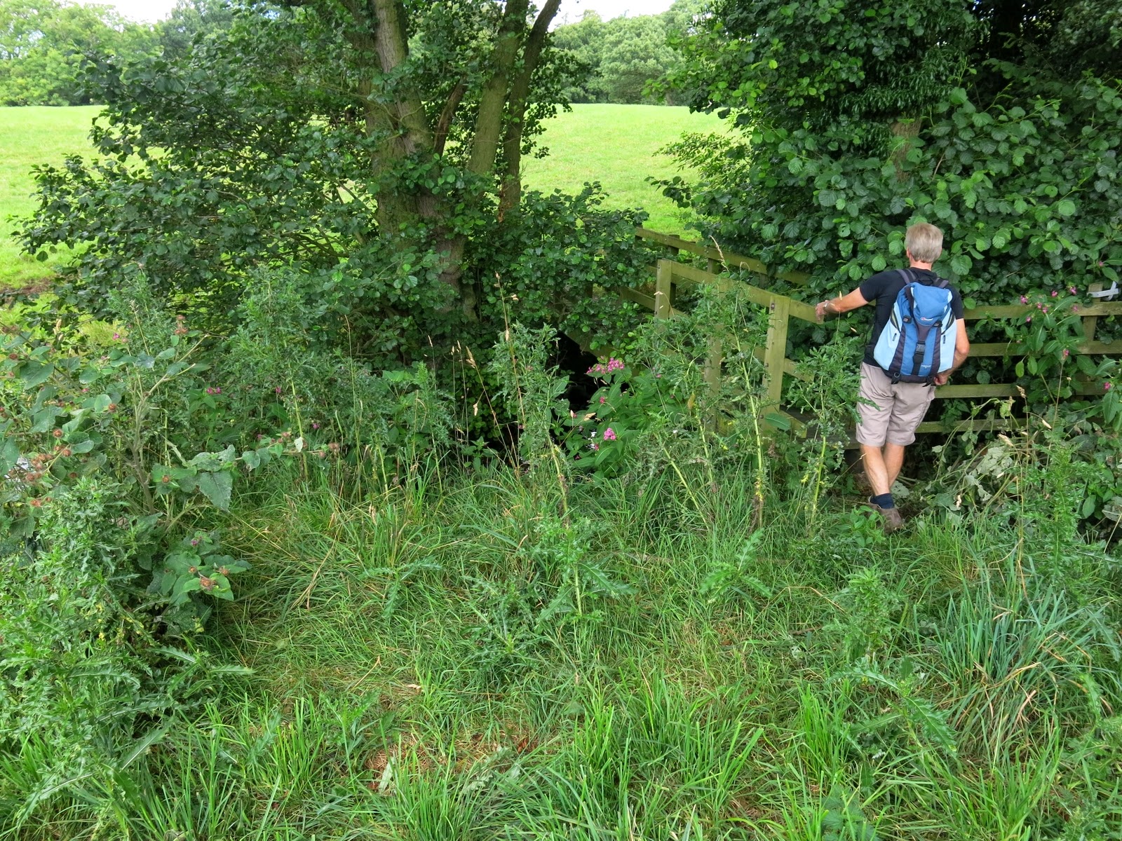
We left the farmer and walked past several fields of Suffolk Sheep stopping to pat a friendly horse that Clive treated to a cough sweet and which it appeared to love. We emerged from the fields where the road enters Nether Silton and made a left onto the road shortly followed by a right, back into more fields. Several of the fields in today's walk were full of cattle and here, after reading a warning notice on the gate of a field we had to enter, we kept to the hedge-side while many cows and a large brown bull impassively watched us hurrying by. We passed Hall Farm and walked through overgrown fields following a path thick with nettles and briers until we came to a footbridge. The ponds shown above on Tom Scott Burns' map, which he says were man made, are no longer to be seen.
 |
| Drat, it's still early August |
 |
| We walk quickly by.... |
 |
| First bridge of the day |
|
|
Our overgrown footpath continued to a small stone bridge over what used to be a 3.5 mile narrow gauge railway, built in 1833, that brought limestone mined near Kepwick to kilns near to the Yarm and Thirsk turnpike road. Another field traversed and we joined Peasland Lane which we followed for a mile into Cowesby. Cowesby Church looked lovely in the sunshine and we sat on the step to enjoy our coffee and scones.
 |
| Overgrown paths of nettles |
 |
| Cowesby Church hidden behind enormous yews |
 |
| That step looks ideal for a coffee stop |
 |
| Walking out of Cowesby |
We walked through Cowesby past Home Farm and then followed a path bearing left along the western shoulder of Pen Hill. This path was extremely overgrown and we had to fight our way through briers until the path suddenly dropped quickly down to the village of Kepwick. We didn't enter the village, simply crossed the road and entered more fields, the second of which was full of cattle that rushed up to the fence to greet us. We stood on one side of the stile and the cattle on the other in a Mexican Standoff. Minutes passed with neither side moving until Clive stepped briskly over the stile waving his arms causing a sudden stampede with the cows 'high tailing' it to the other side of the field. We walked back across the old railway line and down to a little used footbridge over Sorrow Beck which was covered in branches from adjacent trees.
 |
| Walking up towards Pen Hill |
 |
| Footpath at side of Pen Hill |
 |
| Mexican Standoff |
 |
| "Move 'em on!" |
 |
| Clive fights his way onto bridge |
 |
| We clear the bridge of branches |
Our path led across more fields and returned us to the village of Nether Silton where we passed the Old Manor House and the large monolith erected long ago by Squire Hicks and on which is carved six rows of capital letters. Each letter represents a word which spells the following inscription.
Here The Grand Old Manor House Stood
The Black Beams Were Oak, The Great Walls Were Good
The Walls At The East Wing Are Hidden Here
A Thatched Cottage Like A Barn Was Erected
Year AD 1765
A Wide Porch Spans A Yard And Alcove
 |
| Young pheasants near Kepwick |
 |
| Happy to be hiking again! |
 |
| Clive admires the monolith at Nether Silton |
 |
| See text above for translation |
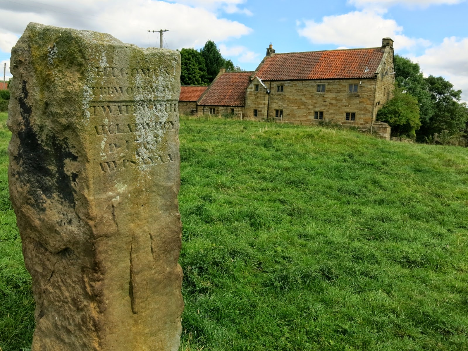 |
| The Old Manor House standing behind the stone |
|
|
We walked past the tidy church at Nether Silton and followed our path back into fields walking parallel to Greystone Farm, crossing Kirk Ings Lane to St Mary's Church, looking abandoned in the middle of a field quite some distance from the village of Over Silton, which it serves. TSB tells us that the church has a Norman doorway and a 14th Century bellcote and the roof beams are old ship's timbers from the yards at Hartlepool. Leaving the church we crossed the field to the road leading back into Over Silton and our car.
 |
| All Saints at Nether Silton |
 |
| St Mary's at Over Silton |
 |
| Leaving St Mary's and walking towards Over Silton |


