"There must be dales in Paradise
Which you and I will find.."

Thursday 10 December 2015


Limekiln House and the Drove Road from Kepwick


5.5 miles                          Cool with grey skies


Tom Scott Burns suggests that Kepwick is derived from the Scandinavian Kaeppi and Vik, producing Kaeppivik which means 'a nook in the hills'.  In Victorian times it was noted for its lime and sandstone quarries and a railway ran from Kepwick to kilns on the Yarm 
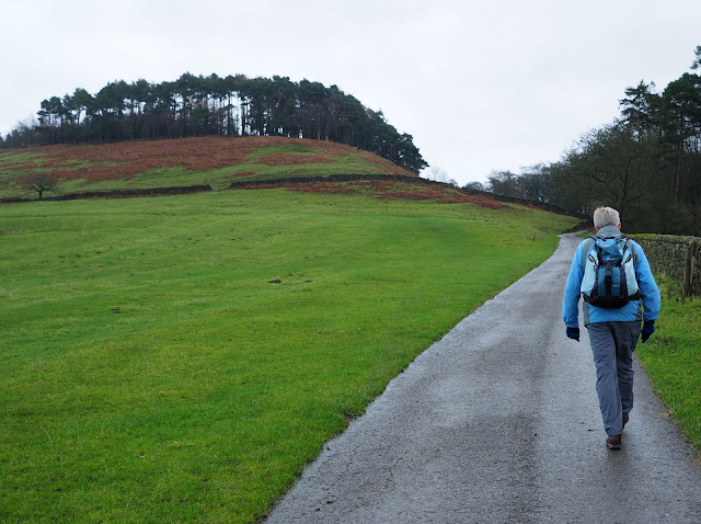
to Thirsk turnpike road.  We approached Kepwick from the A19 and intended to park in the church car park as TSB suggests, but there were agricultural vehicles were parked there.  Instead we left the car at the roadside further into the village.


Today's walk from The Walker's Guide to the Hambleton Hills


We walked through Kepwick coming immediately to the gates of Kepwick Hall where we turned left, following the tarmac road across the remains of the old railway line and then climbing slowly past French Hill Wood to isolated Nab Farm.  


Bear left here away from Kepwick Hall

Normally a small brook, lots of water today

'Take me with you'  Friendly collie at Kepwick

French Hill Wood to our right and The Nab on the left


Pretty colours at French Hill Wood

We walked through Nab Farm pausing to look at the cattle who are all in sheds for winter.  The path keeps to the outskirts of the buildings but was running with deep, thin, mud which we squelched through, admiring the restraint pen with its old clippers on our left.


Restrain pen at Nab Farm

Leaving Nab Farm behind, our path improved slightly and we looked down across the valley, over Bridge Beck towards Whitestone Scar and Kepwick Moor on the horizon.  We could see our path all the way to the high moor.

Leaving Nab Farm and descending to Bridge Beck

We came to the ruins of an old lime kiln and our path climbed quickly away from it, following a nice green path alongside a dry stone wall.  We noticed that the wall was providing a break from the brisk wind so we decided to hunker down behind it to enjoy our coffee and scones.


Old lime kiln

Lime kiln chimney

Looking across at Kepwick Quarry


Preparing our picnic spot

We sat and watched a kestrel hovering for nearly ten minutes as we ate our scones.  Across the heather a grouse moved slowly closer as did a couple of sheep farther down the path, no doubt all drawn by curiosity and the sight of our scones.


We are watched as we enjoy our break

Another ten minutes and they would have been sitting with us

Before they could join us we set off again, briskly uphill, to pass through a gate and join the old drovers' road.  TSB says that at this point we can see the remains of Limekiln House but today all that can be seen is a few stony outcrops and, in the middle of them, a cross with the words 'Bert 7.6.05  RIP'.  Presumably a memorial and not Bert's grave.


The Old Drovers' Road

We turned right and walked along the old drovers' road, pausing occasionally to admire some of the many signs that the authorities have seen fit to erect along this short stretch.  


Cleveland Way Sign

Is this sign really necessary?

A plethora of signs


We followed the drovers' road for nearly two miles, until we reached the remains of Steeple Cross.  TSB tells us that Steeple Cross was referred to as Stepingecross in documents dated 1290 and was probably derived from the old English 'steapinga' - 'dweller on the slope', hence 'crossroads of the hill-dwellers'.  All round this area are Bronze Age earthworks.  We turned right here, into a forestry plantation and began a slow descent along a very wet track which ended at the top of Gallow Hill.  Here the path had been blocked by a fence which is easily climbed, to continue steeply down.  This area is known as Black Hill and there was a nice view across to Kepwick Hall below us.


Along the drovers' road towards the forestry plantation

The remains of Steeple Cross

Turn right through the gate

A choice of paths, we took the upper one

The path is blocked by a fence which must be crossed

Kepwick Hall below Black Hill
Our path became a sunken hollow as it crossed the flat plain of Pen Hill, then as we started to descend Atlay Bank rhododendrons grew thickly on either side for several hundred yards until the track levels into a field. 

 
Slippery path downhill


We have to divert into the woods!

Horse jump built into a stone wall

Down Pen Hill


Atlay Bank

Hollow Lane down Atlay Bank


Here we saw an old stone shed  with water pipes inside it.  TSB explains that in 1873 the Warner family erected Kepwick Hall and made extensive improvements to the estate including the construction of two reservoirs on the moors above, one to supply the house with water and the other for the gardens and terraces.  This building is obviously from that period. 


Clive approaches the old water shed

Inside the shed

We soon reached the road and turned left to walk through Kepwick, past the church which was locked and unwelcoming as on previous visits, and back to our car.


Kepwick Church

Kepwick


Thursday 19 November 2015


Roseberry Topping, Easby Moor and Captain Cook's Monument from Great Ayton


7 miles                                   Dry and cool        


Heavy rain during the last few days made us decide on a moor walk and we thought we'd visit the Cleveland Matterhorn, Roseberry Topping, as we haven't been there for a while.  So not one of Tom Scott Burn's walks today but one I'm sure he would have been familiar with. 


Tracklogs view of today's walk

We parked on the high street in front of the butcher's shop and were amused by a sign in the window showing their pies being consumed on Dove Crag and Ben Nevis.


Pie hiking - Sign in Ayton Butchers

We walked along the high street passing the small school house where Captain Cook was taught as a boy. A sign showed the school is now a museum but that it is only open to visitors from April to October.  We followed the high street and crossed the road to enter a footpath alongside Cleveland Lodge, which we found to be very muddy.


Captain Cook's school


Duck weather-vane on the high street opposite the river


Muddy footpath alongside Cleveland Lodge

Progress gets tricky


We crossed the Middlesbrough to Whitby railway line near Ryehill Farm and continued through farm fields before heading steeply uphill into trees to reach Cliff Rigg Quarry where whinstone was mined until 1973.  We detoured from our path to climb steeply to the ridge of the quarry for a better look. The quarry, which is remarkably large and deep, looks disused and forgotten.


Crossing the railway

Sign at the entrance to Cliff Ridge Wood

Looking along the quarry

The right side of the quarry

Roseberry from Cliff Rigg Quarry

We retraced our steps to rejoin our farm track towards Roseberry, crossing several fields and steadily climbing until we reached Wilson's Folly, a Victorian shooting box on the slopes of Roseberry.


Farm tracks to Roseberry

Approaching Wilson's Folly

Plaque on the shooting box

Roseberry from the shooting box
Leaving the shooting box we continued to climb until we reached the summit, where, standing by the trig point, we enjoyed great views in all directions.

The hill is believed to have been held in special regard by the Vikings who settled here and gave the area many of its place names. They gave Roseberry Topping its present name: first attested in 1119 as Othenesberg, (Othenes (personal name) rock, or Odin's rock.   If the latter, Roseberry Topping is one of only a handful of known pagan names in England, being named after the Norse God Odin.
https://en.wikipedia.org/wiki/Roseberry_Topping       

The locations of this walk made us think of Captain Cook, and standing here on the summit we could see Marton, where I live and where he was born and Ayton where he went to school.  We wondered if he had ever stood here on top of Roseberry, as a youth.  I bet he did.  Next we were going to visit the monument erected to his memory.


Not resting, just reading the graffitti

Great Ayton from Roseberry

Looking towards the coast

Guisborough in the distance

Newton under Roseberry

We walked down from the summit to rejoin our path and saw the first of many newly erected signs we saw today.  We have mixed feelings about them but perhaps they will look better when weathered.


The acorn stands for the Cleveland Way

Looking back towards Roseberry from Newton Moor


With Roseberry behind us we headed south towards Easby Moor and Captain Cook's Monument.  Our path led us down to Gribdale Gate where a picnic table had been thoughtfully positioned for our coffee stop.


Captain Cook's Monument appears in the distance

Coffee and scones at Gribdale


From Gribdale we climbed up towards the monument, stopping briefly to look at a memorial plaque to a British air crew, killed here during WW2. There had obviously been a Remembrance Day visit to the spot, judging by the poppies.  Nice that they are still being remembered.


Memorial Plaque on Easby Moor


Approaching the Monument

Memorial Stone on the Monument

We reached the monument and read through the plaque.  Neither of us had realised that Cook was only 41 when he died.  We walked towards two old gateposts to leave the moor and begin our descent towards Great Ayton.


Great Ayton below us

Looking back as we begin our descent


Pine needles helpfully carpet the mud, making our descent easier

Looking across to Roseberry and Gribdale Terrace


As we reached Dykes Lane we made a decision to stray from our map, as we did not want to walk back through the mud we had experienced on our outward journey, near Cleveland Lodge.  We turned left just before Dykes Lane into a farm track where there was a Weak Bridge sign, and this led us, via the weak railway bridge, to Woodhouse Farm.  We were surprised to see that the farm now hosts a brand new building which is a cafe above and barn below.


We turn left here

Anti-climb bridge!

New cafe at Woodhouse Farm

Huntsman and hounds weather-vane at Woodhouse Farm

Nice house sign with tractor


Swaledale Rams near Brookside Farm

Late butterfly (moth?) Don't know what sort
Do now! Thanks Roger.  It's a Comma Butterfly, unusual in the North

 Reaching Great Ayton we diverted briefly into the Royal Oak for a pint of Deuchars IPA, before walking alongside the Green and returning to our car. 


Statue to James Cook on Ayton Green

War memorial on the village green