Nether and Over Silton to
Thimbleby Hanging Stone
7 miles Fine with cool breeze
This is one of our favourite Tom Scott Burns walk and one we have never done at this time of year. Today it turned out to be worth doing if only to see the display of bluebells at St Mary's in Over Silton.
 |
| Today's walk from The Walker's Guide to the Cleveland Hills |
 |
| Walking up Black Hambleton |
A steady climb took us to Hambleton Street where we turned right into Silton Forest, which now resembles the Somme, most of the trees of Silton Forest having presumably gone to feed the Biomass Boiler at Teesside Power Station.
 |
| Silton Forest |
 |
| Walking through Silton Forest |
 |
| We reach trees again |
 |
| Walking down to Nether Silton |
The forest path becomes a tarmac lane which eventually leads to Kirk Ings Lane, where we turned left, then right, to enter the lovely village of Nether Silton. Turning left off our path, just past the church took us to the Manor Stone with its mysterious inscription. The monument was apparently the idea of Squire Hicks to mark the site of the medieval manor house. I don't know how he expected future readers to interpret his inscription, which takes the form of a mnemonic. It is necessary to know that the first letter of each word is all that is provided and this isn't terribly helpful to the modern reader!
 |
| The carved letters stand for: "Here The Grand Old Manor House Stood, The Black Beams Were Oak The Great Walls Were Good The Walls At The East Wing Are Hidden Here, A Thatched Cottage Like A Barn Was Erected Here AD 1765 A Wide Porch Spans A Yard And Alcove |
 |
| All Saints Church, Nether Silton, whose alter rails were made from wood from HMS Dreadnought from Nelson's Navy |
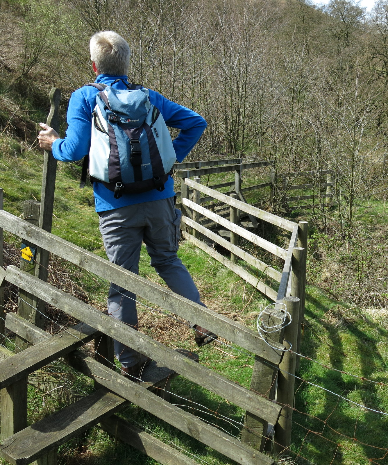
Returning to the road we crossed straight over to a white gate next to a house on which was a post box and a sign saying Old Post Office. Our route was through the white gate and into the green path, although there were no way-marks to indicate a right of way.
 |
| Our path goes through the white gate, no way-sign so look for the post box |
 |
| The footpath through house backs at Nether Silton |
We were amazed to see the church in a sea of bluebells and daffodils and although the daffodils were past their best it still made a splendid sight.
 |
| Across fields.. |
 |
| St Mary's appears in the distance |
 | |
| A sea of bluebells |
We sat in the graveyard on the Jubilee Bench and enjoyed our coffee and scones before spending some time exploring the church and reading the inscriptions on the old gravestones. The church is always open to visitors and has a very peaceful air. No electricity of course and candelabras hanging from the roof. Tom Scott Burns tells us that it still has its original Norman zigzag mouldings around the doorway.
 |
| 'Just in the darling of my youth, then death to me was sent, and you who have a longer stay, be certain to repent' |

 |
| "Where's me scone?" |
 |
| Looking towards the altar |
 |
| The altar window |
 |
| Beautiful colours in the windows |
 |
| The base of an ancient cross |
 |
| Mary, wife of Charles who died April 16th 1788 aged 44. 'Sweet children and husband dear, live still by faith and nothing fear, But sin which is the root of strife, The seed of death the bane of life, What am I now, dust and shade, Yourselves the same, your life doth fade, This I suggest from silent urn, that whilst I speak your heart may burn, and be in flame with heavenly love, Aspiring still to things above' |
 |
| 'Cruel death did soon take them both away, Because on earth they might no longer stay, But hope in Heaven we shall meet again, And there in endless joy always remain' |
We walked across the fields away from the isolated church and towards the village of Over Silton where we passed by the old manor house. TSB tells us that this was once owned by the gallant gentleman Sir George Orby Wombwell, baronet, who served with the 17th Lancers and took part in the charge of the Light Brigade at Balaclava on 25th October 1854. His horse was shot from under him and he was taken prisoner but escaped on a Russian horse to rejoin his brigade and charge again, without sword or pistol! He died in 1913 aged 81. We turned right and walked beyond the houses to a left turn where our path parted from the road and climbed steeply into Crabtree Bank Plantation. The next 2.5 miles were through conifers, sometimes on wide forestry tracks and sometimes on narrow footpaths
 |
| Approaching Over Silton |
 |
| Silton Manor House |
 |
| The old school in Over Silton |
 |
| Leaving the road ..... |
 |
| .... for a steep climb into Crabtree Bank Plantation |
 |
| We leave the path to try and find a route up through the mud |
 |
| Better underfoot once past the junction |
 |
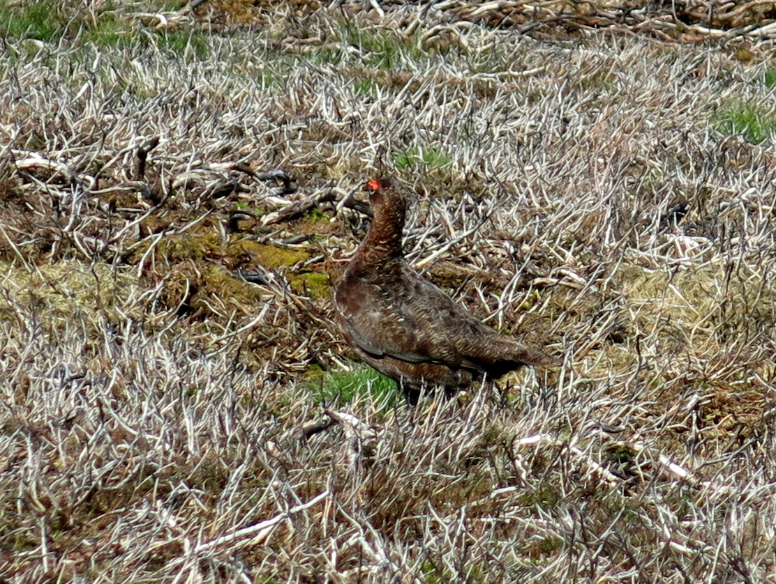
| Hanging Stone |
Shortly after passing Hanging Stone we disturbed a sparrowhawk with its prey but it flew off before I got my camera out. A quick examination showed that it had taken a racing pigeon of which there was little left. Clive examined the bird's rings which showed that it belonged to the Up North Combine and was bred in 2015. He removed the rings with his Leatherman and said he would go online later to register what had happened to the bird.
 |
| Clive discovers the prey was a racing pigeon |
 |
| The blue ring is a micro-chip and the yellow its registration number |
 |
| Clivc removes the rings |
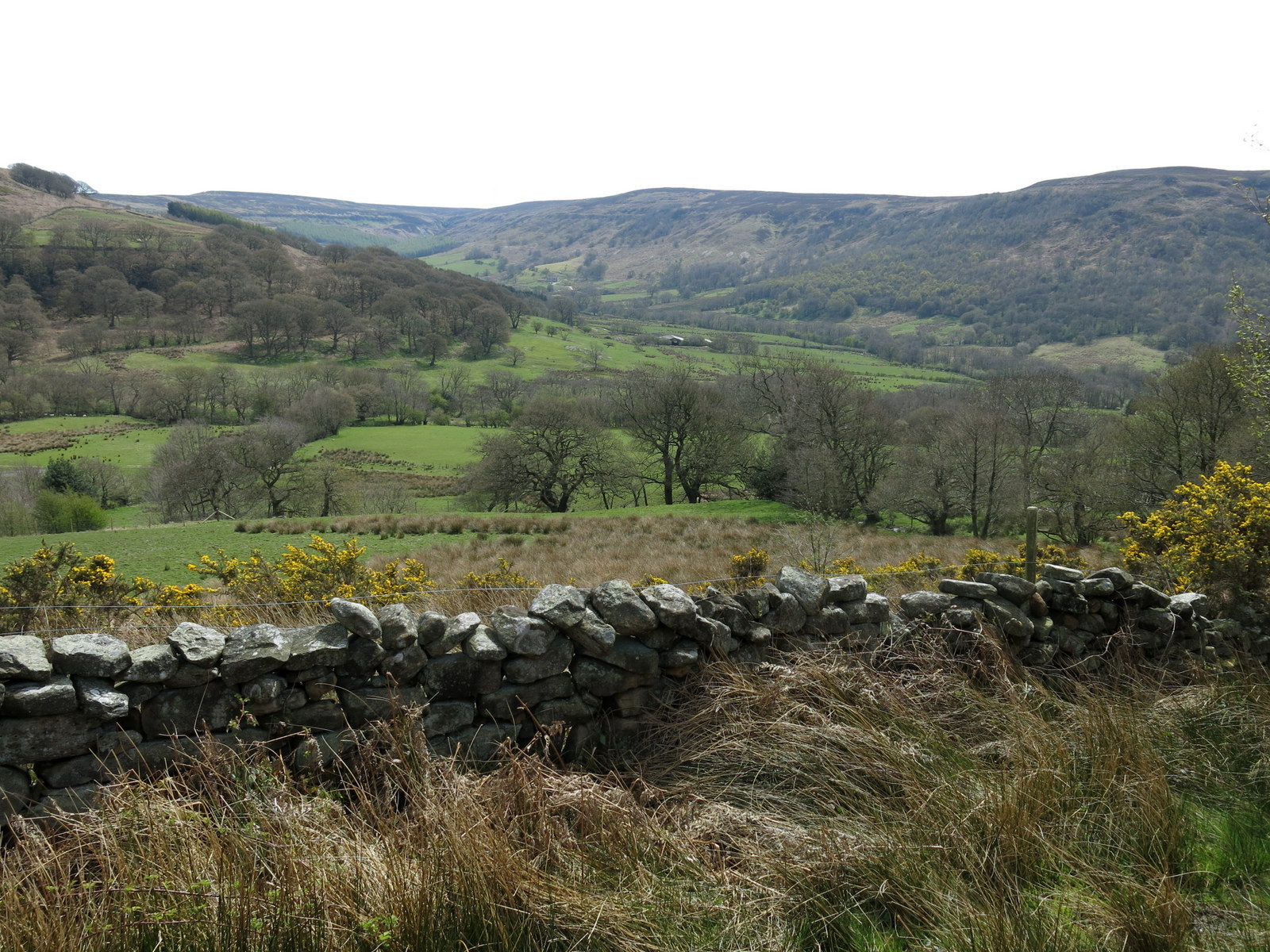
We continued through the woods passing the remains of several more birds. We suspected there must be a hawk's nest very near. A mile or so brought us to a gap in the woods where trees had been felled and although an eyesore it meant we had a good view down to Thimbleby and Osmotherley below us.
 |
| Osmotherley in the distance |
 |
| This time it's a wood pigeon |
 |
| Two miles of woodland paths |
 |
| The unmistakable beak of a woodpecker |
 |
| Leaving Thimbleby Bank Plantation and entering Big Wood |
 |
| Approaching Oakdale |
 |
| Lots of signs to keep us on the straight and narrow |
We came to the descent to Oakdale, usually a tricky affair but a milk run in today's dry conditions. Reaching Oakdale bottom and Jenney Brewsters's Gill we found another mass of bluebells stretching in all directions, one of the finest displays I have seen.
 |
| An easier descent to Oakdale |
 |
| Oakdale |
 |
| Clive crosses Jenny Brewster's Gill |


TSB explains that Jenny Brewster's Gill was supposedly named after a local witch and the spring was once the haunt of smugglers who peddled liquor to the surrounding villages. Several secret stills were dotted about the moors, one being Solomon's Temple, another Wildgoose Nest which stood near Codbeck Reservoir and another at Swainsty Crag on Nether Silton Moor.
 |
| Looking back past our way-post to Big Wood |
 |
| Still working at Oakdale Reservoir |

We were surprised to see work was still being carried out at the old Oakdale Reservoir, apparently to take it out of commission and make it safe. This makes the third year that we know of that this has been in progress, probably a lot longer than it took to build the reservoir in the first place.
 |
| We climb back to the car |
 |
| Clive stops chin-wagging when I remind him that the pub shuts at 3pm |
 | ||
| A weather vane (Jenny Brewster?) at Osmotherly |