Ladhill Gill and Bumper Castle from
Fangdale Beck
7.5miles Changeable weather
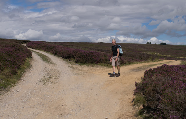
We turned off the B1257 Bilsdale Road
and drove past an old green telephone kiosk to the village of Fangdale
Beck where we parked at the roadside. Tom Scott Burns tells us that
Fangdale comes from the personal Scandinavian name Fangi or Fangulf,
giving 'Fangi's Valley'. Leaving the car we crossed the beck by the
little bridge and walked past the old Wesleyan Chapel, now converted
into a private house.
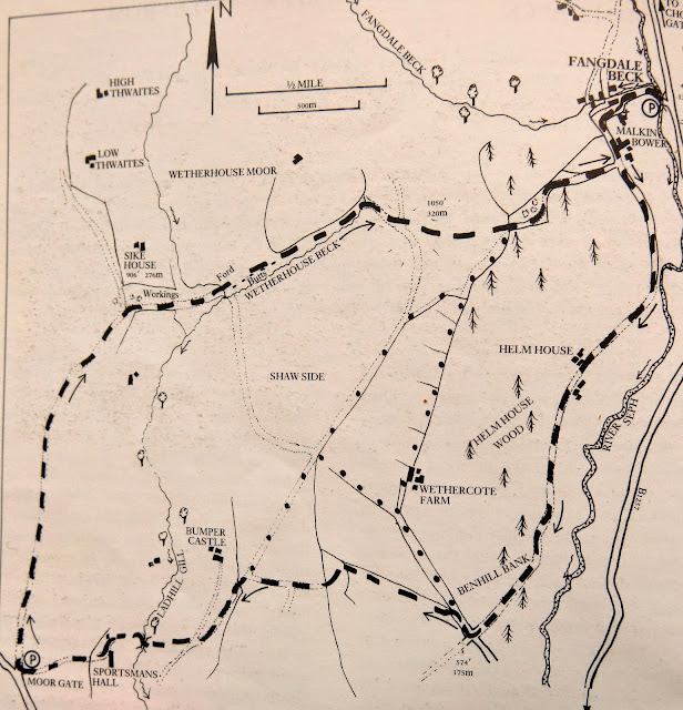 |
| Today's walk from The Walker's Guide to the Cleveland Hills |
 |
| Fangdale Beck |
 |
| Over the bridge.... |
 |
| ... and past the old chapel |
 |
| Looking back at Fangdale |
A walk along a farm track brought us to a farm called Malkin Bower, which apparently means Matilda's or Maud's Dwelling. We continued straight past the farm with the tarmac changing to a grassy track.
 |
| Malkin Bower |
 |
| Weather-vane at Malkin Bower |
 |
| Grassy track |
 |
| Ringlet Butterfly seen on our track |
We followed the path along the valley of
Bilsdale, parallel to the road below us. The track dropped down to the
River Seph before gently climbing up to Helm
House where, last year, we had admired an old tractor and a road roller, ripe for renovation. Sadly no-one has rescued them and they appeared to be returning to nature.
 |
| Last year |
 |
| Last Year |
 |
| This year! |
Leaving Helm House we crossed more sheep fields before arriving at Benhill Bank Plantation where our track climbed steadily up to reach the moor gate.
 |
| Crossing fields after Helm House |
 |
| Bilsdale and the B1257 to our left |
 |
| Climbing steadily up Benhill Bank |
 |
| More fields lead up to the moor |
 |
| A fine drizzle begins as we arrive at the moor gate |
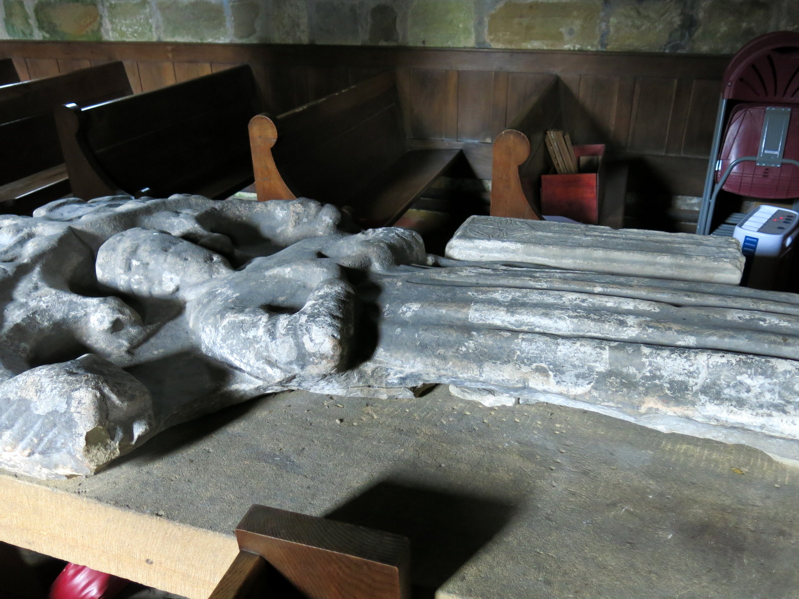
We crossed the moor to look down on the remains of Bumper Castle. Tom Scott Burns reports that the monks of Rievaulx wrought iron on Bumper Moor and there are old spoil heaps still to be seen dotted about on the moor.
Bumper Castle was owned by George Villiers, the notorious second Duke of Buckingham, who, when he died in 1687, had squandered £50,000 a year and was an outcast from society. Only a few stones now remain of the castle and we walked above the ruins before gently dropping down to Ladhill Gill, with Sportsmans Hall above us.
We saw a large table shaped stone just before the Gill and decided to sit there for our coffee and scones, before crossing a bridge over Ladhill Gill.
 |
| Descending to Ladhill Gill, Sportsmans Hall beyond the trees |
 |
| The remains of Bumper Castle |
 |
| Sportsmans Hall |
|
 |
Our thoughts turn to coffee and scones
We crossed the bridge and climbed steeply up the opposite side of the valley, turning left to join a track that led us above Sportsmans Hall. TSB suggests that this name probably has something to do with Bumper Castle and the Duke's sporting pastimes.
| | | | |
|
|
 |
| Over Ladhill Gill |
 |
| Ladhill Gill |
 |
| Looking back over Ladhill Gill to the moor |
 |
| We pass above Sportsmans Hall |
We walked towards the Hawnby road and turned right along a vehicle access track at the moor gate. The track divides twice and on each occasion we took the right fork, heading towards Bilsdale mast.
 |
| Looking back towards Hawnby Hill |
 |
| Following the vehicle track over the moor |
 |
| Early heather |
 |
| Easterside Hill to the left and Hawnby Hill |
 |
| Take the right fork |
 |
| Ruined smallholding |
Eventually our path struck off faintly across the moor. We lost sight of the track occasionally but it didn't matter, we knew we had to head east to cross the upper reaches of Ladhill Gill, where it joins with Wetherhouse Beck. Here the route is indicated by a row of wooden stakes showing the location of some shooting butts.
This part of the walk is a bit hit and miss, the moor track being either non-existent or overgrown, but eventually we reached the shooting butts and we turned left to follow their line.
 |
| Heading towards the shooting butts |
At one point I got my camera out to take a shot and by good fortune some grouse flew up in front of me. I was able to get a pleasing snap of them.
 |
| Red Grouse |
 |
| .. and another |
 |
| Crossing Wetherhouse Beck |
 |
| We reach the shooting butts |
 |
| We make our own path |
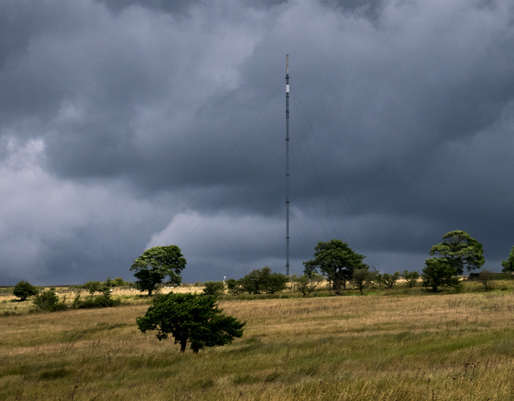
 |
| Bilsdale Mast in the distance |
 |
| Walking along the line of shooting butts |
As we passed one butt Clive noticed that there appeared to be animal remains and jumping in found three tiny skulls and some bones and fur. We examined the skulls, at first thinking they might be bird skulls before deciding that they were baby rabbits. We wondered if a bird of prey brought them here to feed on them but noticed a rabbit hole at the side of the butt and decided it was more likely to be an accident. The baby rabbits had fallen into the wood lined butt and been unable to get out.
We walked along checking the other butts but the tragedy appears to have been a one-off.
 |
| Clive examines some fur and bones |
 |
| Rabbit skulls |
 |
| This rabbit hole might explain the mystery |
The track then followed a dry stone wall to the moor top. We passed a rounded hillock and then bore right between two plantations.
 |
| Leaving the moor |
We went through the moor gate and by some old quarries and then descended via the usual hollow way to emerge at Malkin Bower where we turned left to return to Fangdale and our car.
 |
| Old hollow way |
 |
| Disused quarries |
 |
| A steep descent |
 |
| Fangdale appears below |