Wass to Cockerdale and Byland Abbey
7 miles Dull and windy
We approached Wass from the A19 Thirsk turn off and found the village hall car park full so parked at the side of the road in front of the Church of St Thomas.
 |
| Today's walk from The Walker's Guide to the Hambleton Hills |
 |
| The Church of St Thomas |
 |
| Inside facing the altar |
The church was unlocked so we entered and found it to be clean, tidy with a capacity of about 40. Tom Scott Burns doesn't mention the building but it was once the village school and appears to have been built using stone from nearby Byland Abbey.
TSB does tell us, however, that Wass comes from the Middle English wathes, or fords, the village having two such crossings.
We walked back down to the crossroads and turned right at the pub. In 2015 when we last walked here this pub was the Wombwell Arms but we noticed it has been renamed the Stapylton Arms.
We walked away from the pub along a road that soon lost its tarmac and became little more than a track. We passed a sign to Cam Farm and Observatory, the only sign for the observatory that we noticed, then passed through woods with Blind Side Gill to the right and Abbey Bank Noddle to the left. This was a steady climb which suddenly got steeper as we followed our path off the track to the ridge of Snever Scar.
TSB praises the surprise view of the Vale of York from Snever Scar but that has long since been spoiled by quick growing saplings. The path leads along the ridge and then descends until it reaches a track that makes its way left uphill, just before reaching a gate. There is no sign here but we remembered that we needed to take this track on the left in order to see the observatory and once more we made our way to the top of Snever Scar, where the stone folly known as The Observatory came into view.
We would have like to climb the folly to take in the view but as the door was firmly locked this was not to be, so we retraced our steps through the wood to the gate where we turned left into fields.
According to TSB these fields were the scene of the Battle of Bylands in 1322, when King Edward II was defeated by Sir Robert de Brus of Scotland. The king only escaped by 'the very pity of Christ' leaving behind in his flight the royal treasure and the crown jewels.
Our path led us to Cam Farm where we had to keep a lookout for way markers, before reaching Cockerdale Wood. As we passed through the wood we went left from the forest track on to a small path that descends steeply through the wood perimeter, where we saw Cockerdale Farm standing in the centre of a large meadow. All these paths were very muddy and slippery. The water table of the meadow, like all the others we crossed today, appeared to have reached maximum and we sank inches deep into the grass as we walked.
After Cam House we passed through a gate into Cockerdale wood where we descended through the trees, eventually passing Cockerdale Farm.
Passing the farm we reached a track at Mode Hill and here we turned right to climb sharply to the little chapel at Scotch Corner. TSB tells how this was built by the sculptor John Bunting,with stone from an old farmhouse and is dedicated to three pupils killed in WWII.
Our plan was to sit here for our coffee and scones, but it was tricky to find a spot out of the wind, as trees that once secluded the chapel have recently been felled. Eventually we settled on a spot and had to admit, even though draughty, the tree felling allowed us a splendid view over the Vale of York.


We retraced our steps down Mode Hill and saw some Exmoor ponies in a field below us, looking quite happy, despite being out in the winter wind.

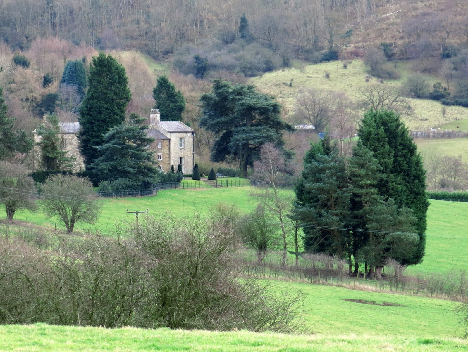
The lane led us down to the village of Oldstead where we turned left to walk towards imposing Oldstead Hall, where we paused to feed apples to a donkey who trotted over to beg from us.
We walked through wet fields and then turned right, then left on the tarmac of the Oldstead to Byland Road to walk through fields once more and passing by Oldstead Grange Farm and then Cam Heads Farm.
We now crossed a series of linking field tracks to reach the ruins of Byland Abbey. It is still apparent what an imposing building this must have been in its day.
TSB tells us that the church, in itself 330 feet long, was fringed by chapels and columns, only traces of which remain. When the Abbey was dismantled in 1540 after the suppression on the monasteries by Henry VIII it housed 25 monks as well as the Abbot. An interesting webpage about the monastery, showing a reconstruction of how it looked in its heyday, is here.


We followed the road through the village and then turned off at Abbey House where we crossed fields and meadowland to reach our car parked at Wass.
A quick change out of our muddy boots and we were in the Stapylton Arms. We forgot to ask why the name had been changed although we did find that there had been a change of owner, to whom we chatted over a fine pint of Helmsley Brewery's Howardian Ale.
We agreed that this walk has a lot going for it, the observatory at Mount Snevner, the pretty valley of Cockerdale, the quiet chapel at Scotch Corner and the ruins of Byland Abbey, enough variety to satisfy any walker!
 |
| The Stapylton Arms |
 |
| Cottage garden, Wass |
We walked away from the pub along a road that soon lost its tarmac and became little more than a track. We passed a sign to Cam Farm and Observatory, the only sign for the observatory that we noticed, then passed through woods with Blind Side Gill to the right and Abbey Bank Noddle to the left. This was a steady climb which suddenly got steeper as we followed our path off the track to the ridge of Snever Scar.
 |
 |
| A steady climb |
 |
| Up to Snever Scar |
TSB praises the surprise view of the Vale of York from Snever Scar but that has long since been spoiled by quick growing saplings. The path leads along the ridge and then descends until it reaches a track that makes its way left uphill, just before reaching a gate. There is no sign here but we remembered that we needed to take this track on the left in order to see the observatory and once more we made our way to the top of Snever Scar, where the stone folly known as The Observatory came into view.
 |
| Turn left at this gate to visit the observatory, no sign here! |
 |
| Muddy paths through Snever Wood |
 |
| We reach the 'observatory' |
 |
| Clive reads the inscription |
 |
| "Here hills and waving groves a scene display, And part admit and part exclude the day, See rich industry smiling on the plains, And peace and plenty yell VICTORIA reigns!, Happy the MAN who to these shades retires, Whom nature charms and whom the muse inspires, Who wandering thoughtful in this silent wood, Attends the duties of the wise and good, To observe a mean, be to himself a friend, To follow NATURE and regard his end" |
 |
| John Wormald in the first year of the reign of Queen Victoria, caused this observatory to be built |
According to TSB these fields were the scene of the Battle of Bylands in 1322, when King Edward II was defeated by Sir Robert de Brus of Scotland. The king only escaped by 'the very pity of Christ' leaving behind in his flight the royal treasure and the crown jewels.
Our path led us to Cam Farm where we had to keep a lookout for way markers, before reaching Cockerdale Wood. As we passed through the wood we went left from the forest track on to a small path that descends steeply through the wood perimeter, where we saw Cockerdale Farm standing in the centre of a large meadow. All these paths were very muddy and slippery. The water table of the meadow, like all the others we crossed today, appeared to have reached maximum and we sank inches deep into the grass as we walked.
 |
| Crossing the ancient battlefield |
 |
| Cam Farm |
 |
| Cam House |
 |
| "I'm so glad I cleaned my boots before we came out!" |
 |
| Heavy going |
 |
| Descending through Cockerdale Woods |
 |
| Attractive Cockerdale Farm |
 |
 |
| Mount Snever Observatory on the horizon |
Passing the farm we reached a track at Mode Hill and here we turned right to climb sharply to the little chapel at Scotch Corner. TSB tells how this was built by the sculptor John Bunting,with stone from an old farmhouse and is dedicated to three pupils killed in WWII.
Our plan was to sit here for our coffee and scones, but it was tricky to find a spot out of the wind, as trees that once secluded the chapel have recently been felled. Eventually we settled on a spot and had to admit, even though draughty, the tree felling allowed us a splendid view over the Vale of York.
 |
| Sharp climb to the chapel |
 |
| Who's that lurking on the hill?! |
 |
| This wasn't here last time, perhaps it's from inside the chapel? |

 |
| It would be good to see the stained glass windows from the inside |

 |
| John Joseph Bunting sculptor and artist of Ryedale built this chapel 1957 + died 19 November 2002 aged 75 |
 |
| View from our coffee stop |
We retraced our steps down Mode Hill and saw some Exmoor ponies in a field below us, looking quite happy, despite being out in the winter wind.

 |
| Exmoor Ponies in North Yorkshire |
The lane led us down to the village of Oldstead where we turned left to walk towards imposing Oldstead Hall, where we paused to feed apples to a donkey who trotted over to beg from us.
 |
| Weather vane at Oldstead |
 |
| Oldstead Hall |
 |
| Don't pass me by... |
 |
| Clive digs out an apple to share |
 |
| Got any sweets in that pocket? |
 |
| Bear right at the footpath sign |
We walked through wet fields and then turned right, then left on the tarmac of the Oldstead to Byland Road to walk through fields once more and passing by Oldstead Grange Farm and then Cam Heads Farm.
 |
| This bench is protected but only from very short necked beasts! |
 |
| Heavy going made for slow walking |
 |
| Oldstead Grange |
We now crossed a series of linking field tracks to reach the ruins of Byland Abbey. It is still apparent what an imposing building this must have been in its day.
TSB tells us that the church, in itself 330 feet long, was fringed by chapels and columns, only traces of which remain. When the Abbey was dismantled in 1540 after the suppression on the monasteries by Henry VIII it housed 25 monks as well as the Abbot. An interesting webpage about the monastery, showing a reconstruction of how it looked in its heyday, is here.
 |
| Byland Abbey appears across the fields |


We followed the road through the village and then turned off at Abbey House where we crossed fields and meadowland to reach our car parked at Wass.
A quick change out of our muddy boots and we were in the Stapylton Arms. We forgot to ask why the name had been changed although we did find that there had been a change of owner, to whom we chatted over a fine pint of Helmsley Brewery's Howardian Ale.
 |
| Old railway sign at house in Byland |
 |
| Weather-vane at Byland |
 |
| Weather vane at Abbey House |
 |
| Abbey House, Old Byland |
 |
| The end of the walk |