Hazel Head to Arnsgill and Cow Ridge
7 miles Fine and sunny
For reasons that will soon be apparent we think of this walk as The Lime Kiln Way.
We approached Hazel Head Car Park via a 7 mile drive along the unclassified road from Osmotherley. We drove past Square Corner and after driving past the ford at Blow Gill ('ravine with the dark ford') parked at Hazel Head car park, some distance uphill.
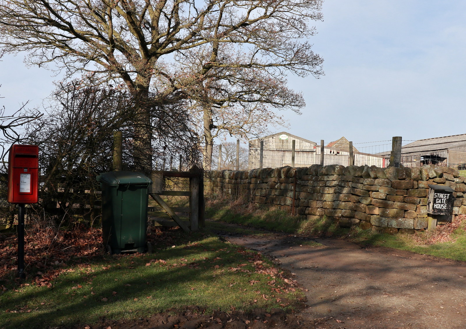
After donning our boots we returned down the road, back to Blow Gill, where we admired the waterfall and an old lime kiln at the side of the road before climbing back up the road to the entrance to Street Gate Farm.
 |
| Today's walk from The Walker's Guide to the Hambleton Hills |
 |
| Steep downhill walk to Blow Gill.... |
 |
| ... and our first Lime Kiln of the day |
 |
| Blow Gill |
 |
| Looking downstream |
 |
| Steep uphill to Street Gate Farm |
Tom Scott Burns explains that a number of farmers in the region had their own lime kilns for burning lime, which was used for lime washing walls and dressing the land, a custom going back to Roman times. The lime neutralises the acid in the moorland soil allowing more varied crops to be grown. We had passed another well preserved lime kiln in the car a mile or so further back and we would shortly see yet more on today's walk. These high farms would have used the lime to reclaim moorland.
The farm track leads past Street Gate Farm and into South Wood. Even though it was lovely and sunny today the path was very overgrown and wet. This is an old lane and TSB tells how these lanes were used by tinkers and pedlars who became very numerous in the Middle Ages. These travelling salesmen not only sold their goods but were also played a big part in circulating news and delivering letters between settlements.
 |
| Leaving the road at Street Gate Farm |
 |
| Looking over to Arden Great Moor |
 |
| Street Gate Farm |
 |
| Pedlars' way between the farms |
The track leads past another farm, Hagg House, where our arrival was heralded by a deafening cacophony of barking from a pen of spaniels.
We continued along the wet lane until we reached Birk Wood Farm where we turned right and climbed steeply to reach a tarmac lane.
 |
| Approaching Hagg House Farm |
 |
| Spaniels! |
 |
| Turn right before Birkwood Farm |
A steep climb through fields brought us to a tarmac road, Hall Lane, where we examined another lime kiln near to Plane Tree Farm.
 |
| Uphill! |
 |
| Lime kiln near Plane Tree Farm |
We left the Lane at a new gate to start another steep climb to reach the moor. Here we walked along the edge of the moor, looking over to the grand building of Snilesworth Lodge. Eventually our path dropped from the moor to reach Arnsgill Beck which is crossed by a footbridge.
 |
| Passing the moor gate |
 |
| Snilesworth Lodge |
 |
| Walking along the edge of the moor |
 |
| Keeper's Cottage |
 |
| Dropping down towards Arnsgill Beck |
 |
| Metal fox target |
 |
| Footbridge... |
 |
| ... and mud! |
After negotiating a muddy field we climbed steeply once again, this time to Hill End Farm. On our left we saw yet another lime kiln in good repair.
 |
| Hill End Farm |
 |
| Looking down to our muddy field and bridge |
 |
| Snilesworth Lodge |
 |
| Lime Kiln at Hill End |
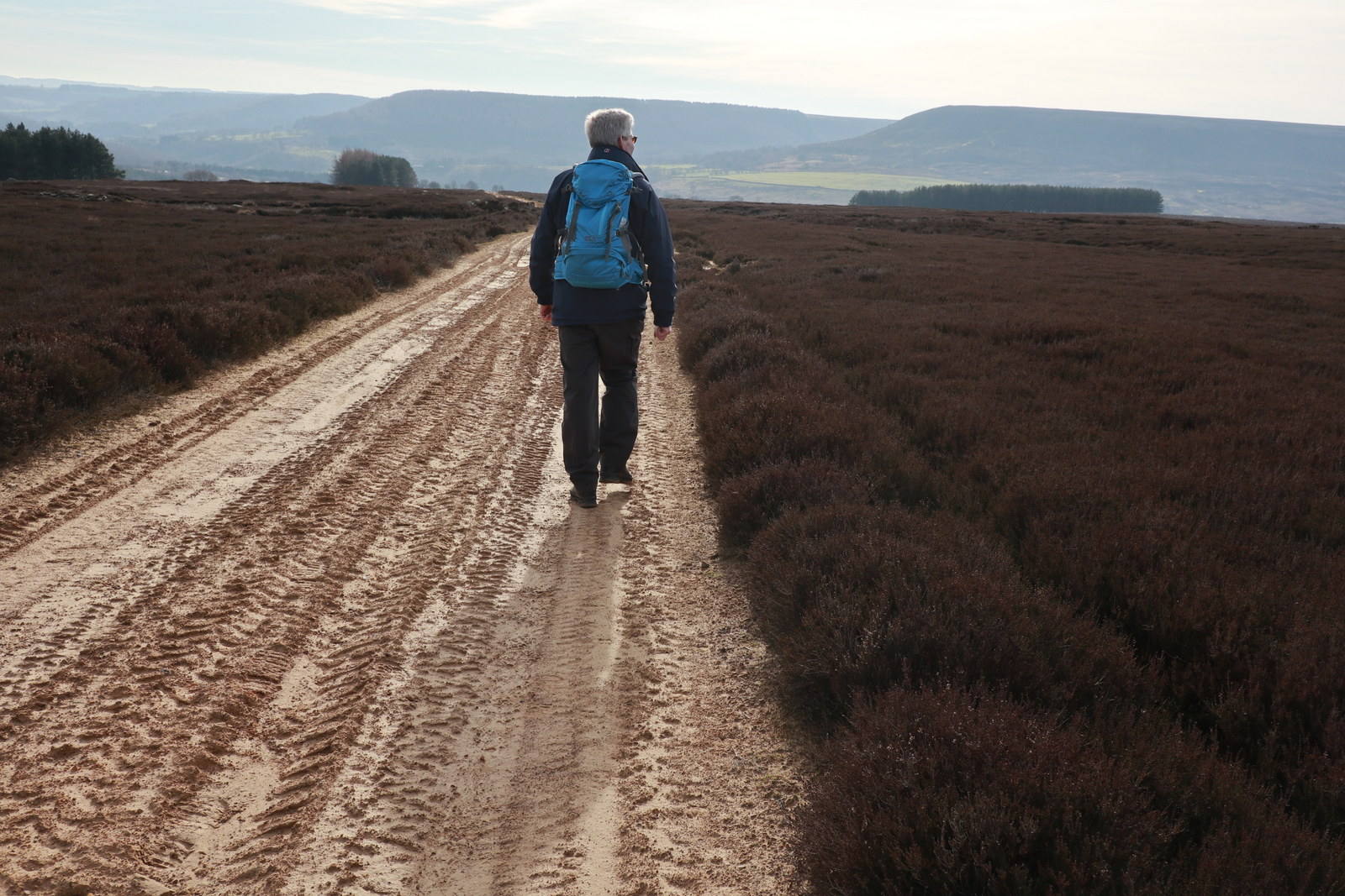
Our climb took us to the top of Arnsgill Ridge and we followed a shooters' track through the moor gate and towards a small plantation of conifers. Just after the trees we came to a large flat stone which would make a fine seat and table and decided to stop for coffee and scones.
 |
| The gamekeeper passes us by |
 |
| Along the shooter's track |
 |
| Time for coffee |
We resumed our walk and followed the path across the moor for a couple of miles before coming to a fork. Here we turned right to drop down to Head House, an abandoned farm which is now used by the keepers for storage of bird food and the like. A familiar building as a couple of our walks converge on Head House, which is always unlocked and a good shelter if the weather is poor.
 |
| Checking the shooting butts for trapped animals. |
 |
| Moorland path |
 |
| Head House below |
 |
| Head House |
Leaving Head House we dropped down to re-cross Arns Gill and then climbed to Cow Ridge. We strode out along the moor path for a couple of miles passing fairly near to Bilsdale Mast.
 |
| Looking back to Head House from Cow Ridge |
 |
| A couple of miles of moorland walking |
 |
| Concrete 'puddle' for game birds |
 |
| Bilsdale Mast |
We came to a cairn which marks the location of Iron Howe. TSB points out that all along this stretch are well preserved field boundaries and over 3,000 cairns dating from 2,300 to 800 BC. Although they don't show well in the photographs they are in fact very noticeable as you walk along this stretch of the path.
 |
| Approaching Iron Howe |
 |
| Cairn at Iron Howe |
 |
Remains of Bronze Age dwellings
|
We started to walk from Iron Howe downhill back towards Blow Gill. Over to the left are fine views of Hawnby Hill and Easterside Hill. As we did so a large turbo prop plane passed low overhead, we wondered what its mission might be ?
 |
| Duck! |
 |
| Low and loud! |
We followed our path past the strangely named Scotland Farm, spotting the old Wesleyan Chapel on the left, where we have stopped to rest on previous walks.
 |
| Scotland Farm |
 |
| Easterside and Hawnby Hills |
 |
| Wesleyan chapel |
 |
| Weather vane near Scotland Farm |
 |
| Mary Queen of Scots stayed at nearby Arden Hall on the way to her execution, is that the reason for this unusual name? |
We rejoined the road for a short walk down to Blow Gill and the car park. The drive home took us past the Queen Catherine at Osmotherley so we stopped for a pint, to toast Tom Scott Burns and to discuss the day's walk.
 |
| "To TSB!" |


