"There must be dales in Paradise
Which you and I will find.."

Friday 13 September 2013


Hawnby, Easterside Hill and Shaken Bridge

7.5 miles, cloudy but fairly warm


We parked next to the restored Wesleyan Chapel in Hawnby and walked back to the T junction where we entered a meadow next to an old green footpath sign.  The grass in the meadow was wet but not too long and we quickly noticed that this doesn't appear to be a well walked path, in fact there doesn't appear to be any path at all.

A climb, picking out where we thought the path should be, led us to some woodland and Easterside Farm where we crossed the road back into more fields under a large mound called Easterside Hill. 

Map from The Walker's Guide to the Hambleton Hills


Hawnby


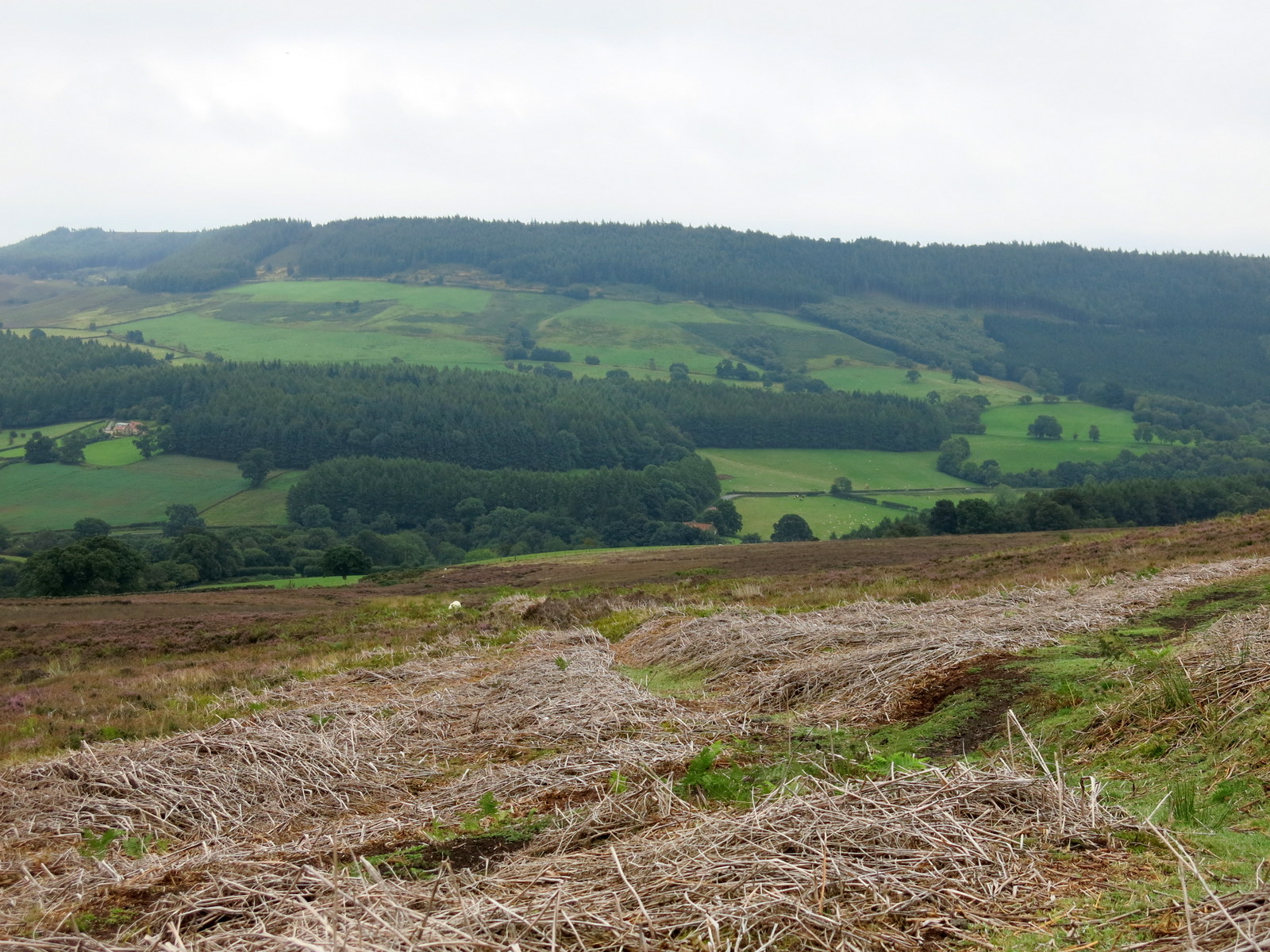
Unfortunately we were not alone in these fields.  A large herd of frisky bullocks raced across towards us and then, just as we were considering climbing the fence they veered off and charged away from us.  We went forward cautiously but the bullocks decided they would accompany us and rushed through the open gate into the next field, where our faint path was leading us.  We followed gingerly and eventually circumnavigated them, leaving them behind as we reached Pepper Hill looking out at the magnificent views towards Bilsdale.


 Pheasant pen near Easterside Hill


As we walked round Pepper Hill we noticed a large gap in the wall on the east side which is mentioned by Tom Scott Burns in his book and which is still not repaired today.  This is the spot where a German Dornier plane crashed in December 1942, killing the four airmen aboard.

Although this point was only about a third of the way through the walk we noticed it was already 11.45am and as we had an excellent view looking down towards the B1257 Helmsley Road below us, we decided this would be a good spot to have our coffee and scones sitting on the scattered stones left in the hollow made by the Dornier.


 Looking across at Sportsman's Hall


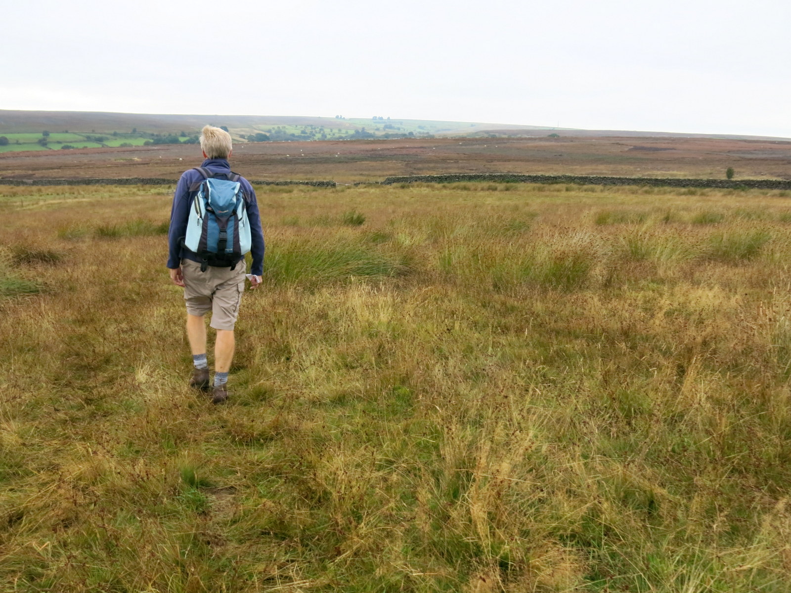
Paths were indistinct for most of the walk

Hole in wall left by WW2 Dornier, Easterside Hill in background

Looking down from our coffee stop towards the B1257


This years heather is now past its best.  Contouring around Pepper Hill

We walked on across more meadows containing horses and this time, some rather sleepy cattle. We crossed a bridge then a path diversion led us around a very smart looking house which TSB describes as a pig rearing farm (Fair Hill Farm) but which now looks like an executive home.  The same path leads past another property called Broadway Foot  Farm but this also no longer looks like a working farm and we were sorry to see that the main building had been destroyed by fire, obviously very recently.


Clive framed by Rowan Trees.  We've noticed a very heavy crop of  berries this year

Sleepy cattle ignored us in this field


 1969 tractor still in use


Bridge near Fair Hill Farm 


We walked down from the burnt building to Shaken Bridge, which TSB explains is from the Old English 'Sceacre Bridge', or Robber's Bridge.  It's now a road bridge with a lovely view of the River Rye and we stood watching a grey wagtail on branches below us before crossing it and turning sharp left into a lane leading upwards to East Ley Wood.  The lane climbed to a large old barn at Peak Scar Top and more magnificent views.  We walked along a nice track at the wood's edge and then exited onto a road which led us gently down to Hawnby Bridge.  As we entered the village a friendly horse came over to see us and after stroking its nose Clive gave it one of his menthol eucalyptus sweets which the horse seemed to relish, stretching its lips back and breathing very noisily.  This brought other horses towards us and we moved quickly off, supplies being limited!


 Weather vane at Broadway Foot

 Broadway Foot main building


 The River Rye from Shaken Bridge


Looking back while climbing to Peak Scar Top

 
 Hawnby from East Ley Woods

 
"Wow, that cleared the tubes!"

A short walk brought us back to the Wesleyan Chapel and our car.
A nice walk but many fields had cattle and horses to negotiate.  Indistinct paths mean it would be wet in winter.

Friday 6 September 2013

Thursday 29 August 2013


Kilburn White Horse Circular

5.5 miles, warm and mostly sunny


When describing this walk in The Walker's Guide to the Hambleton Hills, Tom Scott Burns warns the reader that there is a car park charge at the Information Centre at Sutton Bank.  I wonder what the fee was in 1988 when the book was written and how it compares with today's (2013) charge of £4? 

 Looking across to the cliffs of Roulston Scar


 Memorial near the Gliding Club

 Looking down to Gormire Lake from the escarpment near to the car park

Leaving the car park we walked along the gravelled path towards the dramatic cliffs of Roulston Scar.  The path is used by the Cleveland Way and is adjacent to Sutton Bank Gliding Club which was busily launching gliders into the air, some pulled and released by a small plane and others winched up, the line dropping from the glider as it crossed Roulston Scar. As we walked past the end of the runway a tow-plane and its glider passed straight over our heads.

 The gliding club at Sutton Bank


Tow plane nearly blows my cap off 


The path passed alongside the top of the famous White Horse and we saw an area of white limestone chips, probably the head of the horse.  It was impossible to make out the features of the horse from so close up and sadly, at no time on our walk did we get a view of the whole animal!

 Another view of Roulston Scar


 The view towards Thirsk from the escarpment


 National Trust path above the White Horse


 These white stone chips are our only view of the White Horse


A steep descent took us down to a car park and we then joined a track alongside the road which eventually led us to another car park next to Acre House, where we turned right onto a bridleway.
 
We then walked for some time through woods until we emerged with a nice view across to Hood Grange Farm.  We decided we had walked far enough without refreshment and sat enjoying our scones and coffee, watching the gliders swooping above us.


 Looking up towards Roulston Scar


 Gliders swooping above us


 Looking across at Hood Grange Farm from our coffee stop


Dark clouds threaten as Clive walks towards Hood Grange Farm


A straight path to Hood Grange Farm and then across the A170 road and onto a pleasant trail that led us to High Cleaves Farm.   After the farm a stiff climb took us to Gormire Lake, a surprisingly large expanse of water.  We walked round the lake, puzzled that such a beautiful spot was empty of people during the summer holidays, and then started another steep climb through trees to Sutton Brow and leading to our car park.


 Our first glimpse of Gormire Lake

 Looking through bull-rushes across Gormire Lake

This was an enjoyable walk but many of the paths we walked are managed by the National Trust or Yorkshire Wildlife Trust and were overly maintained, so there was no feeling of being alone in the natural environment.


Friday 23 August 2013

Kepwick, Limekiln House and the Old Drove Road

5.5 miles, warm and sunny

Our walk from The Walker's Guide to the Hambleton Hills


We parked at the Church Hall car park in Kepwick and as we set off several calves ran over to see us.  They were lowing mournfully and had probably just been separated from their mothers; they seemed to be asking us to do something about it. 

 Where's my mummy?

 Gatehouse to Kepwick Hall

 Walking towards Nab Farm


We walked through Kepwick admiring some fine gardens and passed the grand entrance to Kepwick Hall before crossing the old railway line and leaving the road, heading along the farm track to Nab Farm.  Walking on past the farm we came to the remains of an old lime kiln, the furnace and chimney almost intact.  We strolled up Kepwick Moor  watching two peregrine falcons swooping overhead, their cross-bar markings showing clearly.  As we climbed we admired the cliffs of Whitestone Scar to the left and the old limestone quarries and their spoil tips to the right.  After a long and steady climb we reached Hambleton Street and the ruins of the old drovers inn, Limestone House, by which time I was ready for a little something so we sat among the ruins to enjoy our coffee and scones.  Nearby we saw a memorial cross with a slate inscribed 'Bert 1905', and speculated as to who Bert might have been and what his connection was with this place?


Cattle restraint pen at Nab Farm


 Our path runs diagonally across centre of photograph
Little Moor

 The top of a ruined limekiln

Limekiln


Refreshed we followed the old drove road which also forms part of the Coast to Coast Trail and is known as Hambleton Street.  As we walked we enjoyed the smell of heather and noticed how many peacock butterflies there were to be seen on this hike, a fact remarked on by Tom Scott Burns in The Walker's Guide to the Hambleton Hills.  Eventually we arrived at a weathered standing stone which is the remains of Steeple Cross, apparently mentioned in a document of 1246.  To the right of the drove road at this point is a long barrow dating back 3000 years, but try as we might we couldn't make it out amongst the dense bracken and heather.


 Disused limestone quarry and spoil heaps


 Peacock butterfly

Looking back towards Nab Farm to the right and Kepwick in centre distance


We turned right at Steeple Cross and headed into a conifer forest for a while before descending gently to the mixed  woodland of Cowesby Wood.  According to TSB's notes we should skirt along this wood then descend over moorland alongside Pen Hill but wire fencing had been added to the wooden fence that crossed our path, giving the impression that there was no right of way.  We wondered if someone had replaced a stile incorrectly, deliberately or otherwise?   Looking ahead we could see the faint outline of our trail continuing and after consulting the map and my GPS and knowing ourselves to have right of way, we climbed over the fence and joined the track which soon became a much broader trail leading down towards Atlay Bank. 

 Bert's memorial


 The Old Drove Road
 Bull and cows alongside Drove Road

Approaching Steeple Cross

When we reached the escarpment above Atlay Bank we walked back and forth with a fine view down into Kepwick.  Unfortunately we could see no sign of our trail down.  We could see where the map and GPS said the track should be so we pushed our way into high bracken to find it and after a few yards we came to the channelled path that plunged down Atlay Bank, through rhododendron bushes and back to the road and our car waiting at the church hall.

 Looking down at Kepwick from Atlay Bank but where's the track?


 Clive enters the bracken


 Kepwick Church