The Hanging Stone and High Cliff from Gribdale Gate
8 miles Misty start then bright and fine
In The Walker's Guide to the Cleveland Hills, Tom Scott Burns relates a curious belief from a 19th century book called 'Customs of the North Riding' which states, 'Anyone who dares to stand near Gribdale Gate on New Year's Eve at midnight will see an old man pass through and then vanish'. Fortunately it is well into January as Clive and I drive through the gate and park.
 |
| Today's walk from The Walker's Guide to The Cleveland Hills |
 |
| Looking back down to our car as we climb Great Ayton Moor |
 |
| Wet paths on Great Ayton Moor |
From the car park we climbed steeply on to Great Ayton Moor and followed the path alongside a dry stone wall for a little over a mile until we reached a gate at Newton Moor. There was a nice view here over towards Roseberry Topping but we turned right and followed a forestry track until it descended to the surprise view at Hanging Stone.
 |
| Roseberry Topping from Great Ayton Moor |
 |
| Surprise View at Hanging Stone |
 |
| Old graffiti on Hanging Stone 'MPH 1905' |
 |
| Standing on Hanging Stone |
|
|
|
After we had examined the huge sandstone block of Hanging Stone our route descended sharply through Hutton Lowcross Woods and was so muddy that we were relieved to stay upright after which we reached a forestry track. Turning right here we followed the track for a few yards and then once again plunged left down through the woods on another slippery path.
 |
| Looking back towards Hanging Stone |
 |
| In the distance our next destination, Highcliff Nab |
 |
| Gated road at Hutton Village |
|
|
|
Eventually we reached the road and walked towards Hutton Village. TSB tells us that Hutton Village was built during the ironstone mining boom of the 1850s and that the 1861 census showed 50 miners out of a population of 271. Now the houses are quite exclusive and we passed quickly between them and on through a gate to a forestry track which soon climbed steeply through conifers to Bold Venture Gill. Here the road forks, the right fork leads to High Cliff Farm and the left, our path, continued upward to the base of Highcliff Nab. There was a well placed bench here and we sat in the sun to enjoy our coffee and scones with fine views in all directions.
 |
| Looking into the woods near Bold Venture Gill |
 |
| Our first glimpse of Highcliff Nab |
 |
| A walker descends from the Nab as we enjoy our coffee |
 |
| Our view the other way from our coffee stop, towards Guisborough |
Much refreshed we followed the track from Highcliffe Nab west towards Codhill Heights. 'Cod' is derived from the Viking word 'Keld', which means 'spring'. This area is well walked and also used by cyclists and horse riders, added to which farm beasts are using the same tracks. This combination of heavy use together with recent rain made the next half mile very difficult and we picked our way carefully through thick mud until we reached a junction with the paved path of the Cleveland Way.
 |
| Highcliffe Farm |
 |
| Gruesome totems, to frighten other rabbits? |
 |
| Our path becomes a quagmire |
 |
| We reach the Cleveland Way |
Crossing straight over the Cleveland Way our track headed roughly south with Codhill Heights to our right and Sleddale to our left. Sleddale is from the Old English word slaed, meaning wide valley, and nestled at the end of this wide valley was Sleddale Farm, where our path turned right towards Percy Cross Rigg.
 |
| Codhill Heights |
 |
| Looking back along Codhill Heights |
 |
| Sleddale Farm |
|
Reaching Percy Cross Rigg our track turned right onto a tarmac road which we followed, enjoying fine views in all directions until we came to a small fenced area of uneven ground covered in dense heather. TSB tells us that this is the site of Iron Age Hut Circles, dated to around 800 BC and which were excavated in the 1960s. Unfortunately heather has reclaimed this site and the only thing left to see is the metal sign describing the find.
 |
| Unfortunately these hut circles are no longer preserved |
 |
| The location of the Iron Age Hut Circles |
 |
| Walking along Percy Cross Rigg |
We walked along Percy Cross Rigg, once a prehistoric track connecting settlements at Eston Moor, Great Ayton Moor and the Crown End Settlement in Westerdale, until we reached the end of Lonsdale Plantation. This meeting of paths is actually the junction of four parishes, Guisborough, Kildale, Great Ayton and Hutton Lowcross, although there is no sign to that effect. However, we did notice a sign declaring the area a Site of Special Scientific Interest and saw that someone had obscured the word 'Motorcycles' from the prohibitions on the sign. This junction is where we turned left from Percy Cross Rigg to cut across the moor on a green path with Lonsdale Bowl to our left.
 |
| Meeting of tracks at Lonsdale Plantation |
 |
| Highcliff Nab in the far distance |
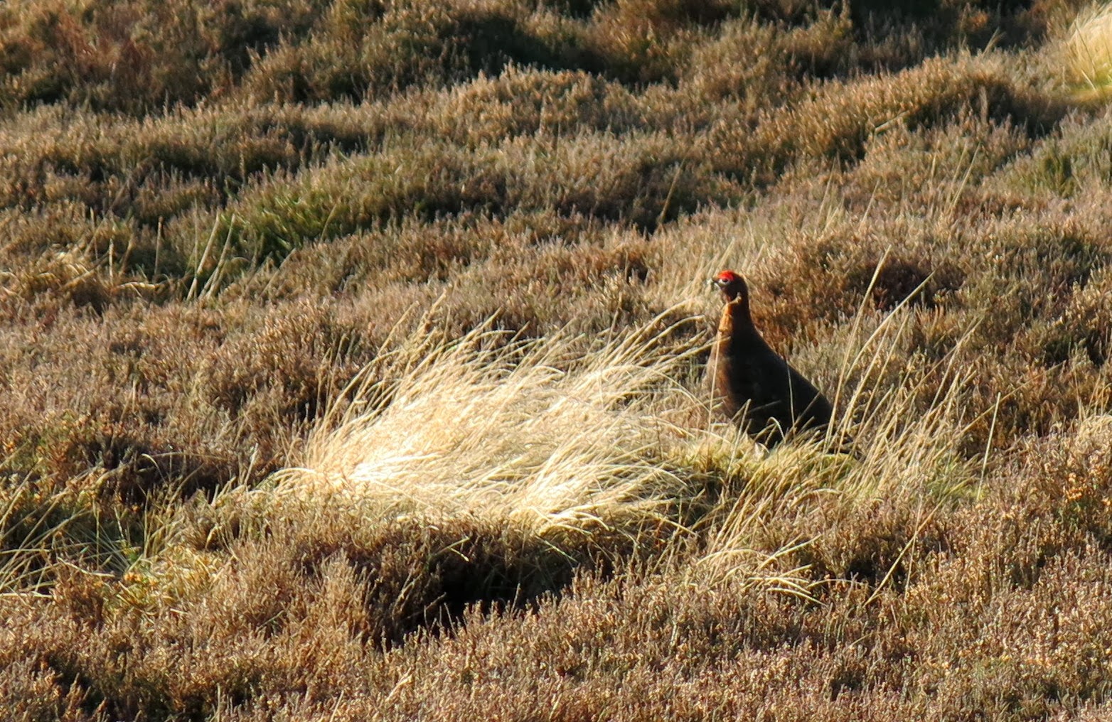 |
| A grouse watches us pass by |
We crossed Great Ayton Moor with our path becoming ever more boggy and rutted, until we crossed the lip of the moor and looked back down at our car parked at Gribdale Gate.
 |
| Lonsdale Bowl |
 |
| Descending to the Car Park |


